UN
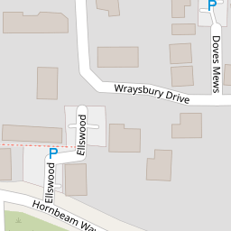
12 Ellswood
£ 240,000
Description
We don't have a Description for this property.
- Bedrooms
- 2
- Bathrooms
- 0

Leaflet © OpenStreetMap contributors
The heatmap indicates the level of crime in the area. The color of the heatmap indicates the crime severity and recency.
Metrics Year-on-Year
- Average area value
- 497,727.00 £Decreased by 14.48 %
- Average area rental value
- 2,500.00 £/moIncreased by 61.29 %
- Est rental Yield
- 6.03 %Increased by 88.44 %
- Crime Rate
- 2.00 %Unchanged by 0.00 %
from 581,990.00 £
from 1,550.00 £/mo
from 3.20 %
from 2.00 %
Nearby Schools
| Name | Type | Ofsted | Distance |
|---|---|---|---|
| Laindon Park Primary School & Nursery | Academy Converter | 0.51 KM | |
| Noak Bridge Primary School | Academy Converter | 1.00 KM | |
| The James Hornsby School | Academy Sponsor Led | Good | 1.22 KM |
| Bas10 The All About Family Hub Delivery Site | Children's Centre Linked Site | 1.22 KM | |
| Millhouse Primary School | Community School | Good | 1.37 KM |
Images
Nearby Streets
| Name | Average Price | Average Sqft | Distance |
|---|---|---|---|
| Yew Close | £ 645,000 | 0 | 0.00 KM |
| Sains | £ 300,000 | 0 | 0.00 KM |
| Dickens Court | £ 190,000 | 0 | 0.00 KM |
| Fore Street | £ 260,000 | 0 | 0.00 KM |
| Tunnel Under Residential Homes | £ 410,000 | 0 | 0.00 KM |
Nearby Transport
| Name | NLC | TLC | Distance |
|---|---|---|---|
| Laindon | 7445 | LAI | 2.39 KM |
| Basildon | 7494 | BSO | 2.91 KM |
| Billericay | 6871 | BIC | 5.28 KM |
| Stanford-Le-Hope | 7458 | SFO | 8.02 KM |
| Pitsea | 7452 | PSE | 8.16 KM |
Nearby Listings
| Address | Price | Type | Score | Distance |
|---|---|---|---|---|
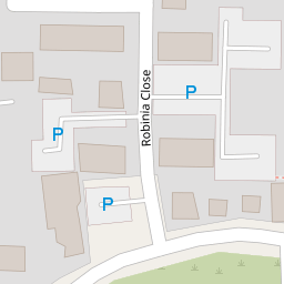
| Wraysbury Drive, Laindon, Basildon | £ 400,000 | BUY | Unknown | 0.03 KM |
| Robinia Close | £ 200,000 | BUY | 7 / 10 | 0.07 KM |
| Robinia Close, Laindon, Basildon | £ 185,000 | BUY | 5 / 10 | 0.09 KM |
| Robinia Close, Basildon, SS15 | £ 330,000 | BUY | Unknown | 0.09 KM |
| Robinia Close, Laindon, Basildon, SS15 | £ 350,000 | BUY | 6 / 10 | 0.09 KM |
Nearby Properties
| Address | Price | Distance |
|---|---|---|
| 5 Ellswood | £ 158,000 | 0.00 KM |
| 12 Ellswood | £ 240,000 | 0.00 KM |
| 6 Ellswood | £ 95,000 | 0.00 KM |
| 7 Ellswood | £ 82,000 | 0.00 KM |
| 14 Ellswood | £ 350,000 | 0.00 KM |