UN
6 Abbot Close
£ 192,000
Description
We don't have a Description for this property.
- Bedrooms
- 3
- Bathrooms
- 0


Leaflet © OpenStreetMap contributors
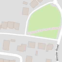
The heatmap indicates the level of crime in the area. The color of the heatmap indicates the crime severity and recency.
Metrics Year-on-Year
- Average area value
- 376,338.00 £Increased by 8.40 %
- Average area rental value
- 1,329.00 £/moDecreased by 6.93 %
- Est rental Yield
- 4.24 %Decreased by 14.17 %
- Crime Rate
- 2.00 %Unchanged by 0.00 %
from 347,169.00 £
from 1,428.00 £/mo
from 4.94 %
from 2.00 %
Nearby Schools
| Name | Type | Ofsted | Distance |
|---|---|---|---|
| St Andrew'S Academy | Academy Special Converter | 0.33 KM | |
| Breadsall Hill Top Primary School | Academy Sponsor Led | Good | 0.58 KM |
| Da Vinci Academy | Academy Sponsor Led | Good | 0.59 KM |
| Tuition Services Co Brookside School | Miscellaneous | 0.76 KM | |
| Breadsall Cofe Vc Primary School | Voluntary Controlled School | Good | 0.98 KM |
Images
Nearby Streets
| Name | Average Price | Average Sqft | Distance |
|---|---|---|---|
| Steeple Close | £ 0 | 0 | 0.00 KM |
| Mansfield Road | £ 425,000 | 0 | 0.00 KM |
| Knutsford Green | £ 0 | 0 | 0.00 KM |
| Ullswater Close | £ 155,000 | 0 | 0.00 KM |
| Sandringham Road | £ 170,000 | 0 | 0.00 KM |
Nearby Transport
| Name | NLC | TLC | Distance |
|---|---|---|---|
| Derby | 1823 | DBY | 3.60 KM |
| Spondon | 1699 | SPO | 5.74 KM |
| Peartree | 1687 | PEA | 6.03 KM |
| Duffield | 1691 | DFI | 6.14 KM |
| Belper | 1679 | BLP | 9.35 KM |
Nearby Listings
| Address | Price | Type | Score | Distance |
|---|---|---|---|---|
| Corbel Close, Oakwood | £ 240,000 | BUY | Unknown | 0.11 KM |
| Corbel Close, Oakwood | £ 300,000 | BUY | 6 / 10 | 0.13 KM |
| Corbel Close, Oakwood, Derby, Derbyshire | £ 250,000 | BUY | 7 / 10 | 0.14 KM |
| Lychgate Close, Oakwood, Derby, DE21 2DA | £ 325,000 | BUY | 6 / 10 | 0.19 KM |
| Applemead Close, Breadsall Hilltop, Derby | £ 162,000 | BUY | 6 / 10 | 0.20 KM |
Nearby Properties
| Address | Price | Distance |
|---|---|---|
| 4 Abbot Close | £ 205,000 | 0.00 KM |
| 23 Abbot Close | £ 153,000 | 0.00 KM |
| 5 Abbot Close | £ 142,500 | 0.00 KM |
| 9 Abbot Close | £ 192,000 | 0.00 KM |
| 21 Abbot Close | £ 159,950 | 0.00 KM |