UN
19 Battleswick
£ 185,000
Description
We don't have a Description for this property.
- Bedrooms
- 2
- Bathrooms
- 0
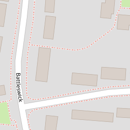
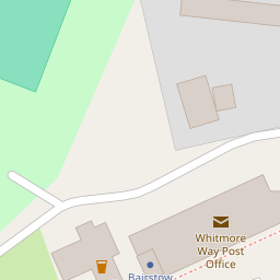

Leaflet © OpenStreetMap contributors
The heatmap indicates the level of crime in the area. The color of the heatmap indicates the crime severity and recency.
Metrics Year-on-Year
- Average area value
- 345,573.00 £Increased by 2.58 %
- Average area rental value
- 1,422.00 £/moIncreased by 6.92 %
- Est rental Yield
- 4.94 %Increased by 4.22 %
- Crime Rate
- 3.00 %Unchanged by 0.00 %
from 336,871.00 £
from 1,330.00 £/mo
from 4.74 %
from 3.00 %
Nearby Schools
| Name | Type | Ofsted | Distance |
|---|---|---|---|
| Whitmore Primary School And Nursery | Academy Sponsor Led | Good | 0.47 KM |
| Bas7/A Fryerns Farm Family Hub Delivery Site | Children's Centre Linked Site | 0.86 KM | |
| The Basildon Lower Academy | Academy Sponsor Led | Good | 1.21 KM |
| Greensted Junior School | Academy Sponsor Led | Outstanding | 1.53 KM |
| Greensted Infant School And Nursery | Academy Converter | 1.53 KM |
Images
Nearby Streets
| Name | Average Price | Average Sqft | Distance |
|---|---|---|---|
| Barrington Close | £ 0 | 0 | 0.00 KM |
| Darwin Court | £ 0 | 0 | 0.00 KM |
| Isis Way | £ 0 | 0 | 0.00 KM |
| Pendle Close | £ 337,500 | 0 | 0.00 KM |
| Havalon Close | £ 230,000 | 0 | 0.00 KM |
Nearby Transport
| Name | NLC | TLC | Distance |
|---|---|---|---|
| Pitsea | 7452 | PSE | 3.35 KM |
| Basildon | 7494 | BSO | 3.81 KM |
| Wickford | 6891 | WIC | 4.94 KM |
| Laindon | 7445 | LAI | 7.21 KM |
| Billericay | 6871 | BIC | 9.11 KM |
Nearby Listings
| Address | Price | Type | Score | Distance |
|---|---|---|---|---|
| Battleswick, Basildon, SS14 | £ 450,000 | BUY | 7 / 10 | 0.16 KM |
| Whitmore Way, Basildon, Essex, SS14 | £ 325,000 | BUY | Unknown | 0.19 KM |
| Holden Walk, Basildon, Essex, SS14 | £ 350,000 | BUY | 7 / 10 | 0.26 KM |
| Whitmore Way, Basildon, Essex, SS14 | £ 100,000 | BUY | 5 / 10 | 0.33 KM |
| Whitmore Way, Fryerns, SS14 | £ 375,000 | BUY | 7 / 10 | 0.37 KM |
Nearby Properties
| Address | Price | Distance |
|---|---|---|
| 24 Battleswick | £ 160,000 | 0.00 KM |
| 39 Battleswick | £ 175,000 | 0.00 KM |
| 26 Battleswick | £ 290,000 | 0.00 KM |
| 35 Battleswick | £ 210,000 | 0.00 KM |
| 45 Battleswick | £ 60,000 | 0.00 KM |