UN
2 Church Road
£ 485,000
Description
We don't have a Description for this property.
- Bedrooms
- 2
- Bathrooms
- 0
- Sqft
- 76.00
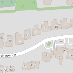

Leaflet © OpenStreetMap contributors
The heatmap indicates the level of crime in the area. The color of the heatmap indicates the crime severity and recency.
Metrics Year-on-Year
- Average area value
- 456,667.00 £Decreased by 3.43 %
- Est sale value
- 63,916.00 £Increased by 89.41 %
- Average area rental value
- 2,099.00 £/moIncreased by 30.13 %
- Est letting value
- 228.00 £/moIncreased by 200.00 %
- Est rental Yield
- 5.52 %Increased by 34.96 %
- Crime Rate
- 26.00 %Unchanged by 0.00 %
from 472,875.00 £
from 33,744.00 £
from 1,613.00 £/mo
from 76.00 £/mo
from 4.09 %
from 26.00 %
Nearby Schools
| Name | Type | Ofsted | Distance |
|---|---|---|---|
| West Lodge School | Other Independent School | 0.60 KM | |
| The Oval | Children's Centre Linked Site | 0.70 KM | |
| Benedict House Preparatory School | Other Independent School | Good | 0.76 KM |
| Birkbeck Primary School | Community School | Good | 0.83 KM |
| Merton Court School | Other Independent School | 0.91 KM |
Images
Nearby Streets
| Name | Average Price | Average Sqft | Distance |
|---|---|---|---|
| Aston Close | £ 0 | 0 | 0.00 KM |
| Victoria Road | £ 0 | 0 | 0.00 KM |
| Sandhurst Road | £ 0 | 0 | 0.00 KM |
| Minshaw Court | £ 0 | 0 | 0.00 KM |
| Willow Tree Court | £ 0 | 0 | 0.00 KM |
Nearby Transport
| Name | NLC | TLC | Distance |
|---|---|---|---|
| Sidcup | 5125 | SID | 1.04 KM |
| Albany Park | 5132 | AYP | 2.62 KM |
| St Mary Cray | 5073 | SMY | 3.33 KM |
| New Eltham | 5119 | NEH | 4.07 KM |
| Welling | 5128 | WLI | 4.49 KM |
Nearby Listings
| Address | Price | Type | Score | Distance |
|---|---|---|---|---|
| Church Road, Sidcup, DA14 6BX | £ 525,000 | BUY | 8 / 10 | 0.00 KM |
| Church Road, Sidcup, DA14 6BX | £ 465,000 | BUY | 7 / 10 | 0.00 KM |
| Church Road, Sidcup, DA14 | £ 525,000 | BUY | 8 / 10 | 0.04 KM |
| Blackhorse Road, Sidcup | £ 425,000 | BUY | 7 / 10 | 0.06 KM |
| Church Avenue, Sidcup, DA14 6BU | £ 595,000 | BUY | 6 / 10 | 0.17 KM |
Nearby Properties
| Address | Price | Distance |
|---|---|---|
| 5 Church Road | £ 410,000 | 0.00 KM |
| 9 Church Road | £ 235,000 | 0.00 KM |
| 2 Church Road | £ 485,000 | 0.00 KM |
| 7 Church Road | £ 451,000 | 0.00 KM |
| 3 Church Road | £ 391,500 | 0.00 KM |