UN
94 Parr Road
£ 212,000
Description
We don't have a Description for this property.
- Bedrooms
- 0
- Bathrooms
- 0
- Sqft
- 8,000.00

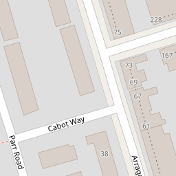

Leaflet © OpenStreetMap contributors
The heatmap indicates the level of crime in the area. The color of the heatmap indicates the crime severity and recency.
Metrics Year-on-Year
- Average area value
- 392,896.00 £Decreased by 13.16 %
- Est sale value
- 3,456,000.00 £Decreased by 7.10 %
- Average area rental value
- 2,078.00 £/moDecreased by 0.67 %
- Est letting value
- 16,000.00 £/moUnchanged by 0.00 %
- Est rental Yield
- 6.35 %Increased by 14.41 %
- Crime Rate
- 2.00 %Unchanged by 0.00 %
from 452,419.00 £
from 3,720,000.00 £
from 2,092.00 £/mo
from 16,000.00 £/mo
from 5.55 %
from 2.00 %
Nearby Schools
| Name | Type | Ofsted | Distance |
|---|---|---|---|
| Cleves Primary School | Academy Converter | 0.15 KM | |
| Central Park Primary School | Community School | Good | 0.49 KM |
| St Edward'S Catholic Primary School | Academy Converter | 0.59 KM | |
| St Stephen'S Primary School | Community School | Outstanding | 0.69 KM |
| St Stephen'S Children'S Centre | Children's Centre | 0.70 KM |
Images
Nearby Streets
| Name | Average Price | Average Sqft | Distance |
|---|---|---|---|
| Seymour Road | £ 525,000 | 0 | 0.00 KM |
| Foxcombe Close | £ 0 | 506 | 0.00 KM |
| Katherine Road | £ 0 | 0 | 0.00 KM |
| Edith Road | £ 500,000 | 0 | 0.00 KM |
| Malvern Road | £ 411,667 | 0 | 0.00 KM |
Nearby Transport
| Name | NLC | TLC | Distance |
|---|---|---|---|
| Woodgrange Park | 7467 | WGR | 1.77 KM |
| Manor Park | 6883 | MNP | 2.16 KM |
| Forest Gate | 6876 | FOG | 2.69 KM |
| Wanstead Park | 7408 | WNP | 2.72 KM |
| West Ham | 7474 | WEH | 4.14 KM |
Nearby Listings
| Address | Price | Type | Score | Distance |
|---|---|---|---|---|
| Cleves Road, E6 | £ 525,000 | BUY | 5 / 10 | 0.14 KM |
| Cleves Road, London, E6 | £ 500,000 | BUY | 5 / 10 | 0.19 KM |
| Grangewood Street, East Ham, London, E6 | £ 450,000 | BUY | 4 / 10 | 0.24 KM |
| Rochford Close, London | £ 330,000 | BUY | 5 / 10 | 0.25 KM |
| Barking Road, East Ham, E6 | £ 250,000 | BUY | 4 / 10 | 0.28 KM |
Nearby Properties
| Address | Price | Distance |
|---|---|---|
| 94 Parr Road | £ 212,000 | 0.00 KM |
| 102 Parr Road | £ 198,000 | 0.00 KM |
| 48 Arragon Road | £ 273,000 | 0.05 KM |
| 32 Arragon Road | £ 250,000 | 0.05 KM |
| 6 Arragon Road | £ 250,000 | 0.05 KM |