UN
1 Halton Close
£ 249,995
Description
We don't have a Description for this property.
- Bedrooms
- 3
- Bathrooms
- 0

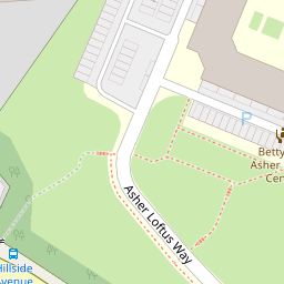


Leaflet © OpenStreetMap contributors
The heatmap indicates the level of crime in the area. The color of the heatmap indicates the crime severity and recency.
Metrics Year-on-Year
- Average area value
- 516,758.00 £Decreased by 12.22 %
- Average area rental value
- 1,977.00 £/moIncreased by 2.97 %
- Est rental Yield
- 4.59 %Increased by 17.39 %
- Crime Rate
- 5.00 %Unchanged by 0.00 %
from 588,706.00 £
from 1,920.00 £/mo
from 3.91 %
from 5.00 %
Nearby Schools
| Name | Type | Ofsted | Distance |
|---|---|---|---|
| Friern Barnet School | Community School | Good | 0.63 KM |
| Holly Park Primary School | Community School | Good | 0.74 KM |
| St John'S Cofe Junior Mixed And Infant School | Voluntary Aided School | Outstanding | 0.76 KM |
| Dwight School London | Other Independent School | 0.80 KM | |
| Coppetts Wood Primary School | Community School | Outstanding | 0.88 KM |
Images
Nearby Streets
| Name | Average Price | Average Sqft | Distance |
|---|---|---|---|
| Pinkham Way | £ 0 | 0 | 0.00 KM |
| Silver Birch Close | £ 0 | 0 | 0.00 KM |
| Queen's Parade Close | £ 0 | 0 | 0.00 KM |
| Scrublands Path | £ 0 | 0 | 0.00 KM |
| Oakwood Crescent | £ 221,250 | 0 | 0.00 KM |
Nearby Transport
| Name | NLC | TLC | Distance |
|---|---|---|---|
| New Southgate | 6019 | NSG | 1.17 KM |
| Oakleigh Park | 6020 | OKL | 3.35 KM |
| Bowes Park | 6027 | BOP | 3.61 KM |
| Alexandra Palace | 6025 | AAP | 3.89 KM |
| New Barnet | 6018 | NBA | 4.77 KM |
Nearby Listings
| Address | Price | Type | Score | Distance |
|---|---|---|---|---|
| Cheddar Close, London | £ 600,000 | BUY | Unknown | 0.18 KM |
| Winterburn Close, London, N11 | £ 650,000 | BUY | 7 / 10 | 0.22 KM |
| MARTOCK GARDENS, FRIERN BARNET, N11 | £ 325,000 | BUY | 6 / 10 | 0.24 KM |
| Coverdale Road, Friern Barnet, London, N11 | £ 700,000 | BUY | Unknown | 0.24 KM |
| Hillside Avenue, London, N11 | £ 900,000 | BUY | 7 / 10 | 0.28 KM |
Nearby Properties
| Address | Price | Distance |
|---|---|---|
| 16 Halton Close | £ 350,000 | 0.00 KM |
| 22 Halton Close | £ 310,000 | 0.00 KM |
| 28 Halton Close | £ 240,000 | 0.00 KM |
| 14 Halton Close | £ 322,000 | 0.00 KM |
| 18 Halton Close | £ 435,000 | 0.00 KM |