UN
1480 High Road
£ 515,000
Description
We don't have a Description for this property.
- Bedrooms
- 2
- Bathrooms
- 0
- Sqft
- 784.00
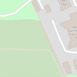
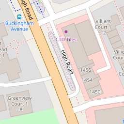

Leaflet © OpenStreetMap contributors
The heatmap indicates the level of crime in the area. The color of the heatmap indicates the crime severity and recency.
Metrics Year-on-Year
- Average area value
- 805,124.00 £Increased by 8.63 %
- Est sale value
- 460,992.00 £Increased by 73.45 %
- Average area rental value
- 2,104.00 £/moDecreased by 10.09 %
- Est letting value
- 784.00 £/moUnchanged by 0.00 %
- Est rental Yield
- 3.14 %Decreased by 17.15 %
- Crime Rate
- 4.00 %Unchanged by 0.00 %
from 741,192.00 £
from 265,776.00 £
from 2,340.00 £/mo
from 784.00 £/mo
from 3.79 %
from 4.00 %
Nearby Schools
| Name | Type | Ofsted | Distance |
|---|---|---|---|
| Pavilion Study Centre | Pupil Referral Unit | Good | 0.88 KM |
| Alma Primary | Free Schools | Good | 1.08 KM |
| St John'S Cofe Primary School | Voluntary Aided School | Good | 1.11 KM |
| Lyonsdown School | Other Independent School | 1.15 KM | |
| Queenswell Infant & Nursery School | Community School | Good | 1.32 KM |
Images
Nearby Streets
| Name | Average Price | Average Sqft | Distance |
|---|---|---|---|
| Oakleigh Road North | £ 485,000 | 0 | 0.00 KM |
| Mowbray Road | £ 0 | 0 | 0.00 KM |
| Kingston Road | £ 0 | 0 | 0.00 KM |
| Station Approach | £ 0 | 0 | 0.00 KM |
| Rowan Walk | £ 585,000 | 0 | 0.00 KM |
Nearby Transport
| Name | NLC | TLC | Distance |
|---|---|---|---|
| Oakleigh Park | 6020 | OKL | 1.21 KM |
| New Barnet | 6018 | NBA | 1.40 KM |
| Hadley Wood | 6075 | HDW | 3.54 KM |
| New Southgate | 6019 | NSG | 4.53 KM |
| Potters Bar | 6022 | PBR | 6.94 KM |
Nearby Listings
| Address | Price | Type | Score | Distance |
|---|---|---|---|---|
| High Road, London | £ 425,000 | BUY | 5 / 10 | 0.08 KM |
| High Road, London | £ 425,000 | BUY | Unknown | 0.08 KM |
| Thatcham Court, High Road N20 | £ 275,000 | BUY | 5 / 10 | 0.08 KM |
| High Road, Whetstone, N20 | £ 425,000 | BUY | Unknown | 0.09 KM |
| Friern Mount Drive, London | £ 20,000 | BUY | Unknown | 0.13 KM |
Nearby Properties
| Address | Price | Distance |
|---|---|---|
| 1482c High Road | £ 196,950 | 0.00 KM |
| 1482b High Road | £ 235,000 | 0.00 KM |
| 1476a High Road | £ 315,000 | 0.00 KM |
| 1482d High Road | £ 225,000 | 0.00 KM |
| 1482a High Road | £ 77,950 | 0.00 KM |