UN
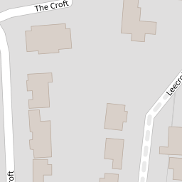
4 The Croft
£ 412,000
Description
We don't have a Description for this property.
- Bedrooms
- 2
- Bathrooms
- 0
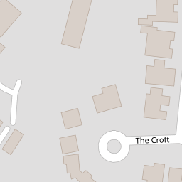

Leaflet © OpenStreetMap contributors
The heatmap indicates the level of crime in the area. The color of the heatmap indicates the crime severity and recency.
Metrics Year-on-Year
- Average area value
- 709,776.00 £Decreased by 19.16 %
- Average area rental value
- 2,364.00 £/moIncreased by 6.49 %
- Est rental Yield
- 4.00 %Increased by 32.01 %
- Crime Rate
- 5.00 %Unchanged by 0.00 %
from 878,000.00 £
from 2,220.00 £/mo
from 3.03 %
from 5.00 %
Nearby Schools
| Name | Type | Ofsted | Distance |
|---|---|---|---|
| Foulds School | Community School | Good | 0.65 KM |
| Queen Elizabeth'S School, Barnet | Academy Converter | 0.67 KM | |
| Underhill Infants School And Children'S Centre | Children's Centre | 0.68 KM | |
| Underhill School | Community School | Requires improvement | 0.72 KM |
| Christ Church Primary School | Voluntary Aided School | Good | 0.95 KM |
Images
Nearby Streets
| Name | Average Price | Average Sqft | Distance |
|---|---|---|---|
| Spring Close | £ 0 | 0 | 0.00 KM |
| Oyster Close | £ 725,000 | 0 | 0.00 KM |
| Dormer Close | £ 665,000 | 0 | 0.00 KM |
| Hill Close | £ 525,000 | 0 | 0.00 KM |
| Galley Lane | £ 1,596,428 | 0 | 0.00 KM |
Nearby Transport
| Name | NLC | TLC | Distance |
|---|---|---|---|
| New Barnet | 6018 | NBA | 3.99 KM |
| Hadley Wood | 6075 | HDW | 4.13 KM |
| Oakleigh Park | 6020 | OKL | 4.96 KM |
| Potters Bar | 6022 | PBR | 5.46 KM |
| Mill Hill Broadway | 1527 | MIL | 6.12 KM |
Nearby Listings
| Address | Price | Type | Score | Distance |
|---|---|---|---|---|
| Dunster Close, Barnet, EN5 | £ 300,000 | BUY | 6 / 10 | 0.14 KM |
| Sutton Crescent, Barnet, EN5 | £ 995,000 | BUY | Unknown | 0.14 KM |
| The Croft, Barnet | £ 900,000 | BUY | 6 / 10 | 0.15 KM |
| Sutton Crescent, Barnet, EN5 | £ 975,000 | BUY | 8 / 10 | 0.16 KM |
| Dunster Close, Barnet | £ 300,000 | BUY | Unknown | 0.17 KM |
Nearby Properties
| Address | Price | Distance |
|---|---|---|
| 6 The Croft | £ 460,000 | 0.00 KM |
| 50 The Croft | £ 845,000 | 0.00 KM |
| 56 The Croft | £ 940,000 | 0.00 KM |
| 42 The Croft | £ 850,000 | 0.00 KM |
| 20 The Croft | £ 728,000 | 0.00 KM |