UN
49 Donnington Road
£ 550,000
Description
We don't have a Description for this property.
- Bedrooms
- 5
- Bathrooms
- 0


Leaflet © OpenStreetMap contributors
The heatmap indicates the level of crime in the area. The color of the heatmap indicates the crime severity and recency.
Metrics Year-on-Year
- Average area value
- 200,667.00 £Decreased by 60.33 %
- Average area rental value
- 1,454.00 £/moDecreased by 8.95 %
- Est rental Yield
- 8.70 %Increased by 129.55 %
- Crime Rate
- 4.00 %Unchanged by 0.00 %
from 505,808.00 £
from 1,597.00 £/mo
from 3.79 %
from 4.00 %
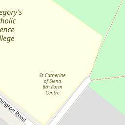
Nearby Schools
| Name | Type | Ofsted | Distance |
|---|---|---|---|
| St Gregory'S Catholic Science College | Academy Converter | Outstanding | 0.27 KM |
| Mount Stewart Infant School | Community School | Good | 0.43 KM |
| Mount Stewart Children'S Centre | Children's Centre | 0.51 KM | |
| Mount Stewart Junior School | Community School | Outstanding | 0.51 KM |
| Uxendon Manor Primary School | Community School | Good | 0.56 KM |
Images
Nearby Streets
| Name | Average Price | Average Sqft | Distance |
|---|---|---|---|
| Ebrington Road | £ 340,000 | 0 | 0.00 KM |
| Southwell Road | £ 1,100,000 | 0 | 0.00 KM |
| Kenton Park Parade | £ 185,000 | 0 | 0.00 KM |
| Cranleigh Gardens | £ 0 | 0 | 0.00 KM |
| The Ridgeway | £ 864,975 | 0 | 0.00 KM |
Nearby Transport
| Name | NLC | TLC | Distance |
|---|---|---|---|
| South Kenton | 1453 | SOK | 1.48 KM |
| Kenton | 1399 | KNT | 1.57 KM |
| North Wembley | 1422 | NWB | 2.19 KM |
| Sudbury And Harrow Road | 1483 | SUD | 3.40 KM |
| Wembley Central | 1423 | WMB | 3.41 KM |
Nearby Listings
| Address | Price | Type | Score | Distance |
|---|---|---|---|---|
| Ebrington Road, Harrow, HA3 | £ 950,000 | BUY | Unknown | 0.14 KM |
| Woodhill Crescent, Harrow, HA3 | £ 780,000 | BUY | 6 / 10 | 0.19 KM |
| Ebrington Road, Harrow, HA3 | £ 850,000 | BUY | 6 / 10 | 0.20 KM |
| Woodhill Crescent, Harrow, HA3 | £ 900,000 | BUY | 7 / 10 | 0.24 KM |
| Woodhill Crescent, Harrow, Greater London, HA3 | £ 700,000 | BUY | 6 / 10 | 0.29 KM |
Nearby Properties
| Address | Price | Distance |
|---|---|---|
| 43 Donnington Road | £ 400,000 | 0.00 KM |
| 53 Donnington Road | £ 660,000 | 0.00 KM |
| 23 Donnington Road | £ 911,000 | 0.00 KM |
| 39 Donnington Road | £ 890,321 | 0.00 KM |
| 21 Donnington Road | £ 265,000 | 0.00 KM |