UN
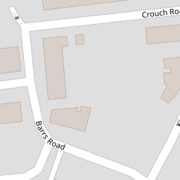
6 Crouch Road
£ 160,000
Description
We don't have a Description for this property.
- Bedrooms
- 4
- Bathrooms
- 0
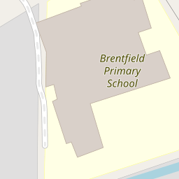

Leaflet © OpenStreetMap contributors
The heatmap indicates the level of crime in the area. The color of the heatmap indicates the crime severity and recency.
Metrics Year-on-Year
- Average area value
- 388,110.00 £Increased by 5.19 %
- Average area rental value
- 1,741.00 £/moDecreased by 3.44 %
- Est rental Yield
- 5.38 %Decreased by 8.19 %
- Crime Rate
- 6.00 %Unchanged by 0.00 %
from 368,969.00 £
from 1,803.00 £/mo
from 5.86 %
from 6.00 %
Nearby Schools
| Name | Type | Ofsted | Distance |
|---|---|---|---|
| Edith Kay Independent School | Other Independent Special School | Good | 0.09 KM |
| Brentfield Primary School | Community School | Good | 0.17 KM |
| Fawood Nursery School & Family Wellbeing Centre | Local Authority Nursery School | Good | 0.36 KM |
| Fawood Children'S Centre | Children's Centre | 0.47 KM | |
| Mitchell Brook Primary School | Community School | Outstanding | 0.65 KM |
Images
Nearby Streets
| Name | Average Price | Average Sqft | Distance |
|---|---|---|---|
| Barrs Road | £ 550,000 | 0 | 0.00 KM |
| Stonebridge Park | £ 350,000 | 0 | 0.00 KM |
| Marshall Street | £ 0 | 0 | 0.00 KM |
| Walton Drive | £ 0 | 0 | 0.00 KM |
| Tallis View | £ 0 | 0 | 0.00 KM |
Nearby Transport
| Name | NLC | TLC | Distance |
|---|---|---|---|
| Harlesden | 1521 | HDN | 1.20 KM |
| Stonebridge Park | 1454 | SBP | 1.61 KM |
| Willesden Junction | 1457 | WIJ | 2.43 KM |
| Wembley Stadium | 1509 | WCX | 2.81 KM |
| Acton Main Line | 3000 | AML | 3.31 KM |
Nearby Listings
| Address | Price | Type | Score | Distance |
|---|---|---|---|---|
| Crouch Road, London | £ 335,000 | BUY | 7 / 10 | 0.01 KM |
| Crouch Road, London, NW10 | £ 375,000 | BUY | 6 / 10 | 0.09 KM |
| Flat 13, Scott House, London, NW10 8JB | £ 325,000 | BUY | 6 / 10 | 0.14 KM |
| Kingthorpe Terrace, Neasden | £ 550,000 | BUY | 6 / 10 | 0.16 KM |
| Kingthorpe Terrace, Brentfield Road, London | £ 550,000 | BUY | 6 / 10 | 0.19 KM |
Nearby Properties
| Address | Price | Distance |
|---|---|---|
| 2a Crouch Road | £ 230,000 | 0.00 KM |
| 12 Crouch Road | £ 270,000 | 0.00 KM |
| 18a Crouch Road | £ 177,000 | 0.00 KM |
| 10 Crouch Road | £ 484,000 | 0.00 KM |
| 28a Crouch Road | £ 180,000 | 0.00 KM |