UN
22 Garston Lane
£ 265,000
Description
We don't have a Description for this property.
- Bedrooms
- 3
- Bathrooms
- 0
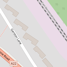

Leaflet © OpenStreetMap contributors
The heatmap indicates the level of crime in the area. The color of the heatmap indicates the crime severity and recency.
Metrics Year-on-Year
- Average area value
- 547,880.00 £Decreased by 10.11 %
- Average area rental value
- 2,287.00 £/moIncreased by 30.17 %
- Est rental Yield
- 5.01 %Increased by 44.80 %
- Crime Rate
- 17.00 %Unchanged by 0.00 %
from 609,526.00 £
from 1,757.00 £/mo
from 3.46 %
from 17.00 %
Nearby Schools
| Name | Type | Ofsted | Distance |
|---|---|---|---|
| Riddlesdown Collegiate | Academy Converter | Outstanding | 0.56 KM |
| Kenley Primary School | Academy Converter | 1.03 KM | |
| Harris Primary Academy Kenley | Academy Sponsor Led | Outstanding | 1.28 KM |
| Gresham Primary School | Community School | Good | 1.98 KM |
| The Hayes Primary School | Community School | Good | 1.99 KM |
Images
Nearby Streets
| Name | Average Price | Average Sqft | Distance |
|---|---|---|---|
| Wildwood Court | £ 0 | 0 | 0.00 KM |
| Bakers Close | £ 825,000 | 0 | 0.00 KM |
| Ravenswold | £ 550,000 | 0 | 0.00 KM |
| Cranford Close | £ 0 | 0 | 0.00 KM |
| Pine Close | £ 850,000 | 0 | 0.00 KM |
Nearby Transport
| Name | NLC | TLC | Distance |
|---|---|---|---|
| Kenley | 5419 | KLY | 1.00 KM |
| Riddlesdown | 5432 | RDD | 1.33 KM |
| Whyteleafe | 5396 | WHY | 1.88 KM |
| Upper Warlingham | 5391 | UWL | 2.24 KM |
| Whyteleafe South | 5439 | WHS | 2.75 KM |
Nearby Listings
| Address | Price | Type | Score | Distance |
|---|---|---|---|---|
| Garston Lane, Kenley, CR8 | £ 475,000 | BUY | Unknown | 0.00 KM |
| Garston Gardens, Kenley, CR8 5AN | £ 450,000 | BUY | Unknown | 0.13 KM |
| Gomshall Gardens, Kenley, CR8 | £ 260,000 | BUY | 7 / 10 | 0.15 KM |
| Gomshall Gardens, Kenley, CR8 | £ 275,000 | BUY | 7 / 10 | 0.15 KM |
| Gomshall Gardens, Kenley, CR8 | £ 270,000 | BUY | 6 / 10 | 0.15 KM |
Nearby Properties
| Address | Price | Distance |
|---|---|---|
| 24 Garston Lane | £ 249,950 | 0.00 KM |
| 34 Garston Lane | £ 370,000 | 0.00 KM |
| 10 Garston Lane | £ 430,000 | 0.00 KM |
| 12a Garston Lane | £ 455,000 | 0.00 KM |
| 2 Garston Lane | £ 323,000 | 0.00 KM |