UN
45 Dalkeith Grove
£ 700,000
Description
We don't have a Description for this property.
- Bedrooms
- 3
- Bathrooms
- 0
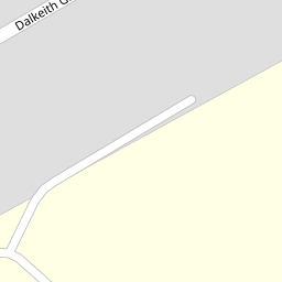

Leaflet © OpenStreetMap contributors
The heatmap indicates the level of crime in the area. The color of the heatmap indicates the crime severity and recency.
Metrics Year-on-Year
- Average area value
- 625,703.00 £Decreased by 3.61 %
- Average area rental value
- 2,383.00 £/moDecreased by 5.55 %
- Est rental Yield
- 4.57 %Decreased by 1.93 %
- Crime Rate
- 2.00 %Unchanged by 0.00 %
from 649,164.00 £
from 2,523.00 £/mo
from 4.66 %
from 2.00 %
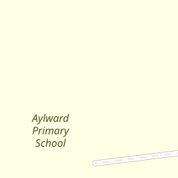
Nearby Schools
| Name | Type | Ofsted | Distance |
|---|---|---|---|
| Aylward Primary School | Academy Sponsor Led | Good | 0.18 KM |
| North London Collegiate School | Other Independent School | 0.26 KM | |
| Avanti House School | Free Schools | Good | 1.13 KM |
| Whitchurch Primary School & Nursery | Community School | Good | 1.14 KM |
| London Academy | Academy Sponsor Led | Good | 1.27 KM |
Images
Nearby Streets
| Name | Average Price | Average Sqft | Distance |
|---|---|---|---|
| Peters Close | £ 654,875 | 0 | 0.00 KM |
| Chestnut Avenue | £ 0 | 0 | 0.00 KM |
| Regents Court | £ 399,250 | 0 | 0.00 KM |
| Augustus Close | £ 0 | 0 | 0.00 KM |
| Stonegrove Court | £ 0 | 0 | 0.00 KM |
Nearby Transport
| Name | NLC | TLC | Distance |
|---|---|---|---|
| Kenton | 1399 | KNT | 4.38 KM |
| Elstree And Borehamwood | 1542 | ELS | 4.55 KM |
| Harrow And Wealdstone | 1397 | HRW | 4.94 KM |
| South Kenton | 1453 | SOK | 5.22 KM |
| Mill Hill Broadway | 1527 | MIL | 5.25 KM |
Nearby Listings
| Address | Price | Type | Score | Distance |
|---|---|---|---|---|
| Dalkeith Grove, Stanmore, HA7 | £ 1,395,000 | BUY | 7 / 10 | 0.05 KM |
| Dalkeith Grove, Stanmore, HA7 | £ 1,600,000 | BUY | 7 / 10 | 0.09 KM |
| Dalkeith Grove, Stanmore, HA7 | £ 1,650,000 | BUY | 7 / 10 | 0.25 KM |
| Cheyneys Avenue, Canons Park, HA8 | £ 575,000 | BUY | 5 / 10 | 0.35 KM |
| Cheyneys Avenue, Edgware, HA8 | £ 625,000 | BUY | 6 / 10 | 0.41 KM |
Nearby Properties
| Address | Price | Distance |
|---|---|---|
| 3 Dalkeith Grove | £ 580,000 | 0.00 KM |
| 35 Dalkeith Grove | £ 702,000 | 0.00 KM |
| 11 Dalkeith Grove | £ 815,000 | 0.00 KM |
| 47 Dalkeith Grove | £ 795,000 | 0.00 KM |
| 33 Dalkeith Grove | £ 570,000 | 0.00 KM |