UN
8 Byron Way
£ 225,400
Description
We don't have a Description for this property.
- Bedrooms
- 3
- Bathrooms
- 0


Leaflet © OpenStreetMap contributors
The heatmap indicates the level of crime in the area. The color of the heatmap indicates the crime severity and recency.
Metrics Year-on-Year
- Average area value
- 276,725.00 £Increased by 12.21 %
- Average area rental value
- 1,095.00 £/moDecreased by 3.69 %
- Est rental Yield
- 4.75 %Decreased by 14.10 %
- Crime Rate
- 5.00 %Unchanged by 0.00 %
from 246,610.00 £
from 1,137.00 £/mo
from 5.53 %
from 5.00 %
Nearby Schools
| Name | Type | Ofsted | Distance |
|---|---|---|---|
| Hilldene | Children's Centre | 0.75 KM | |
| Hilldene Primary School | Community School | Good | 0.78 KM |
| Lime Academy Ravensbourne | Academy Special Converter | Good | 0.94 KM |
| St Ursula'S Catholic Primary School | Voluntary Aided School | Outstanding | 1.08 KM |
| The Royal Liberty School | Academy Converter | Good | 1.15 KM |
Images
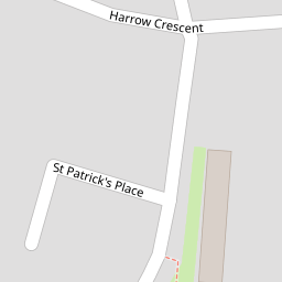
Nearby Streets
| Name | Average Price | Average Sqft | Distance |
|---|---|---|---|
| St Patrick's Place | £ 0 | 0 | 0.00 KM |
| Natasha Court | £ 205,000 | 0 | 0.00 KM |
| Brooklime Path | £ 255,000 | 0 | 0.00 KM |
| Roberts Close | £ 0 | 0 | 0.00 KM |
| Taybury Court | £ 200,000 | 0 | 0.00 KM |
Nearby Transport
| Name | NLC | TLC | Distance |
|---|---|---|---|
| Gidea Park | 6877 | GDP | 1.62 KM |
| Harold Wood | 6879 | HRO | 2.60 KM |
| Emerson Park | 7473 | EMP | 3.25 KM |
| Romford | 6886 | RMF | 3.76 KM |
| Upminster | 7464 | UPM | 6.12 KM |
Nearby Listings
| Address | Price | Type | Score | Distance |
|---|---|---|---|---|
| Harrow Crescent, ROMFORD | £ 450,000 | BUY | Unknown | 0.07 KM |
| Byron Way, Romford, RM3 | £ 375,000 | BUY | 6 / 10 | 0.13 KM |
| Bell Avenue, Harold Hill, RM3 | £ 220,000 | BUY | 5 / 10 | 0.18 KM |
| St Patricks Place, Heaton Grange, Romford, London, RM3 7FD | £ 450,000 | BUY | Unknown | 0.18 KM |
| Wordsworth Close, ROMFORD | £ 625,000 | BUY | 6 / 10 | 0.22 KM |
Nearby Properties
| Address | Price | Distance |
|---|---|---|
| 52 Byron Way | £ 367,995 | 0.00 KM |
| 22 Byron Way | £ 210,000 | 0.00 KM |
| 70 Byron Way | £ 188,000 | 0.00 KM |
| 6 Byron Way | £ 173,500 | 0.00 KM |
| 60 Byron Way | £ 240,000 | 0.00 KM |