UN
10 Amberley Way
£ 94,000
Description
We don't have a Description for this property.
- Bedrooms
- 3
- Bathrooms
- 0
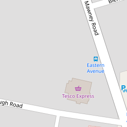

Leaflet © OpenStreetMap contributors
The heatmap indicates the level of crime in the area. The color of the heatmap indicates the crime severity and recency.
Metrics Year-on-Year
- Average area value
- 400,731.00 £Decreased by 13.42 %
- Average area rental value
- 1,775.00 £/moDecreased by 10.49 %
- Est rental Yield
- 5.32 %Increased by 3.50 %
- Crime Rate
- 4.00 %Unchanged by 0.00 %
from 462,857.00 £
from 1,983.00 £/mo
from 5.14 %
from 4.00 %
Nearby Schools
| Name | Type | Ofsted | Distance |
|---|---|---|---|
| Crowlands Primary School | Community School | Good | 1.01 KM |
| Crownfield Junior School | Community School | Good | 1.22 KM |
| Crownfield Infant School | Community School | Good | 1.22 KM |
| The Mawney Foundation School | Foundation School | Good | 1.35 KM |
| Parklands Primary School | Community School | Good | 1.36 KM |
Images
Nearby Streets
| Name | Average Price | Average Sqft | Distance |
|---|---|---|---|
| Pitcairn Close | £ 0 | 0 | 0.00 KM |
| Eastern Avenue West | £ 0 | 0 | 0.00 KM |
| Burnham Road | £ 0 | 0 | 0.00 KM |
| Brooklands Road | £ 397,000 | 0 | 0.00 KM |
| Adams Close | £ 550,000 | 0 | 0.00 KM |
Nearby Transport
| Name | NLC | TLC | Distance |
|---|---|---|---|
| Romford | 6886 | RMF | 2.48 KM |
| Chadwell Heath | 6874 | CTH | 4.06 KM |
| Gidea Park | 6877 | GDP | 4.82 KM |
| Goodmayes | 6878 | GMY | 6.03 KM |
| Emerson Park | 7473 | EMP | 6.58 KM |
Nearby Listings
| Address | Price | Type | Score | Distance |
|---|---|---|---|---|
| Winston Close, Romford, RM7 8LL | £ 250,000 | BUY | Unknown | 0.08 KM |
| Essex Road, Romford | £ 210,000 | BUY | 6 / 10 | 0.11 KM |
| Winston Close, Romford, RM7 | £ 260,000 | BUY | 6 / 10 | 0.15 KM |
| Mawney Road, Romford, RM7 | £ 450,000 | BUY | 6 / 10 | 0.21 KM |
| Crownmead Way, Romford, Essex, RM7 | £ 200,000 | BUY | Unknown | 0.22 KM |
Nearby Properties
| Address | Price | Distance |
|---|---|---|
| 12 Amberley Way | £ 353,000 | 0.00 KM |
| 3 Amberley Way | £ 231,500 | 0.00 KM |
| 45 Amberley Way | £ 184,500 | 0.00 KM |
| 19 Amberley Way | £ 432,000 | 0.00 KM |
| 43 Amberley Way | £ 355,000 | 0.00 KM |