UN
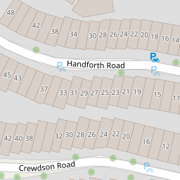
46c Handforth Road
£ 200,000
Description
We don't have a Description for this property.
- Bedrooms
- 2
- Bathrooms
- 0

Leaflet © OpenStreetMap contributors
The heatmap indicates the level of crime in the area. The color of the heatmap indicates the crime severity and recency.
Metrics Year-on-Year
- Average area value
- 1,317,905.00 £Decreased by 10.65 %
- Average area rental value
- 2,872.00 £/moDecreased by 3.72 %
- Est rental Yield
- 2.62 %Increased by 7.82 %
- Crime Rate
- 4.00 %Unchanged by 0.00 %
from 1,474,911.00 £
from 2,983.00 £/mo
from 2.43 %
from 4.00 %
Nearby Schools
| Name | Type | Ofsted | Distance |
|---|---|---|---|
| Reay Primary School | Foundation School | Outstanding | 0.31 KM |
| Ashmole Primary School | Community School | Outstanding | 0.35 KM |
| Archbishop Tenison'S School | Academy Sponsor Led | 0.47 KM | |
| Van Gogh Primary | Academy Converter | 0.59 KM | |
| Henry Fawcett Primary School And Children'S Centre | Children's Centre | 0.60 KM |
Images
Nearby Streets
| Name | Average Price | Average Sqft | Distance |
|---|---|---|---|
| Offley Road | £ 0 | 0 | 0.00 KM |
| Offley Road | £ 0 | 0 | 0.00 KM |
| Offley Road | £ 0 | 0 | 0.00 KM |
| Cranmer Road | £ 825,000 | 0 | 0.00 KM |
| Cowley Mansions | £ 0 | 0 | 0.00 KM |
Nearby Transport
| Name | NLC | TLC | Distance |
|---|---|---|---|
| Vauxhall | 5597 | VXH | 1.32 KM |
| Brixton | 5081 | BRX | 1.80 KM |
| Loughborough Junction | 5082 | LGJ | 1.90 KM |
| Elephant And Castle | 5246 | EPH | 2.27 KM |
| Waterloo | 5598 | WAT | 2.65 KM |
Nearby Listings
| Address | Price | Type | Score | Distance |
|---|---|---|---|---|
| Handforth Road, Oval | £ 750,000 | BUY | 6 / 10 | 0.00 KM |
| Handforth Road, Oval, London, SW9 | £ 500,000 | BUY | 7 / 10 | 0.03 KM |
| Handforth Road, Oval | £ 725,000 | BUY | Unknown | 0.03 KM |
| 33 Handforth Road, London, SW9 | £ 400,000 | BUY | 6 / 10 | 0.05 KM |
| Crewdson Road, Oval, SW9 | £ 2,000,000 | BUY | 7 / 10 | 0.05 KM |
Nearby Properties
| Address | Price | Distance |
|---|---|---|
| 46a Handforth Road | £ 500,000 | 0.00 KM |
| 12 Handforth Road | £ 836,000 | 0.00 KM |
| 26 Handforth Road | £ 135,000 | 0.00 KM |
| 48b Handforth Road | £ 270,000 | 0.00 KM |
| 46b Handforth Road | £ 490,000 | 0.00 KM |