UN
65c Heyford Avenue
£ 573,216
Description
We don't have a Description for this property.
- Bedrooms
- 2
- Bathrooms
- 0
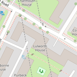

Leaflet © OpenStreetMap contributors
The heatmap indicates the level of crime in the area. The color of the heatmap indicates the crime severity and recency.
Metrics Year-on-Year
- Average area value
- 1,317,905.00 £Decreased by 10.65 %
- Average area rental value
- 2,872.00 £/moDecreased by 3.72 %
- Est rental Yield
- 2.62 %Increased by 7.82 %
- Crime Rate
- 4.00 %Unchanged by 0.00 %
from 1,474,911.00 £
from 2,983.00 £/mo
from 2.43 %
from 4.00 %
Nearby Schools
| Name | Type | Ofsted | Distance |
|---|---|---|---|
| St Stephen'S Church Of England Primary School | Voluntary Aided School | Good | 0.11 KM |
| St Stephens Ce Primary School & Children'S Centre | Children's Centre | 0.12 KM | |
| Wyvil Primary School And Resource Bases For Speech, Language And Communication Needs, And Autism | Foundation School | Outstanding | 0.45 KM |
| Herbert Morrison Primary School | Community School | Outstanding | 0.52 KM |
| St Anne'S Catholic Primary School | Voluntary Aided School | Good | 0.63 KM |
Images
Nearby Streets
| Name | Average Price | Average Sqft | Distance |
|---|---|---|---|
| Bondway | £ 1,443,000 | 0 | 0.00 KM |
| Parry Street | £ 3,163,750 | 0 | 0.00 KM |
| Thorncroft Street | £ 0 | 0 | 0.00 KM |
| Wyvil Road | £ 820,000 | 0 | 0.00 KM |
| Wandsworth Road | £ 1,649,000 | 0 | 0.00 KM |
Nearby Transport
| Name | NLC | TLC | Distance |
|---|---|---|---|
| Vauxhall | 5597 | VXH | 0.67 KM |
| Clapham High Street | 5301 | CLP | 2.05 KM |
| Brixton | 5081 | BRX | 2.06 KM |
| Wandsworth Road | 5372 | WWR | 2.19 KM |
| Loughborough Junction | 5082 | LGJ | 2.65 KM |
Nearby Listings
| Address | Price | Type | Score | Distance |
|---|---|---|---|---|
| Heyford Avenue, Vauxhall | £ 675,000 | BUY | 8 / 10 | 0.02 KM |
| Meadow Road, Vauxhall, London, SW8 | £ 425,000 | BUY | Unknown | 0.07 KM |
| Rita Road, Stockwell, London, SW8 | £ 649,950 | BUY | 5 / 10 | 0.08 KM |
| Rita Road, Vauxhall | £ 600,000 | BUY | 5 / 10 | 0.08 KM |
| DAMAC Tower, Vauxhall, SW8 | £ 1,250,000 | BUY | 7 / 10 | 0.08 KM |
Nearby Properties
| Address | Price | Distance |
|---|---|---|
| 69 Heyford Avenue | £ 462,500 | 0.00 KM |
| 73 Heyford Avenue | £ 145,000 | 0.00 KM |
| 65b Heyford Avenue | £ 552,500 | 0.00 KM |
| 65a Heyford Avenue | £ 630,000 | 0.00 KM |
| 83 Heyford Avenue | £ 435,000 | 0.00 KM |