UN
2 Brocks Drive
£ 560,000
Description
We don't have a Description for this property.
- Bedrooms
- 4
- Bathrooms
- 0


Leaflet © OpenStreetMap contributors
The heatmap indicates the level of crime in the area. The color of the heatmap indicates the crime severity and recency.
Metrics Year-on-Year
- Average area value
- 551,806.00 £Increased by 7.82 %
- Average area rental value
- 2,200.00 £/moIncreased by 10.33 %
- Est rental Yield
- 4.78 %Increased by 2.14 %
- Crime Rate
- 3.00 %Unchanged by 0.00 %
from 511,800.00 £
from 1,994.00 £/mo
from 4.68 %
from 3.00 %
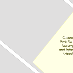
Nearby Schools
| Name | Type | Ofsted | Distance |
|---|---|---|---|
| Cheam Park Farm Primary Academy | Academy Converter | Outstanding | 0.12 KM |
| Brookfield Primary Academy | Academy Converter | Good | 0.47 KM |
| Green Oak Children'S Centre (Formally Stonecot And Worcester Park Children'S Centre) | Children's Centre | 0.82 KM | |
| Green Oak Children'S Centre (Formally Nonsuch And Cheam Sure Start Children'S Centre) | Children's Centre | 0.82 KM | |
| St Cecilia'S Catholic Primary School | Voluntary Aided School | Outstanding | 0.82 KM |
Images
Nearby Streets
| Name | Average Price | Average Sqft | Distance |
|---|---|---|---|
| Westbourne Avenue | £ 1,990,000 | 0 | 0.00 KM |
| The Meads | £ 0 | 0 | 0.00 KM |
| Beeches Road | £ 465,438 | 0 | 0.00 KM |
| London Road | £ 239,000 | 0 | 0.00 KM |
| Esher Avenue | £ 587,500 | 0 | 0.00 KM |
Nearby Transport
| Name | NLC | TLC | Distance |
|---|---|---|---|
| West Sutton | 5293 | WSU | 1.53 KM |
| Sutton Common | 5436 | SUC | 2.06 KM |
| Cheam | 5352 | CHE | 2.24 KM |
| St Helier | 5290 | SIH | 2.39 KM |
| Morden South | 5291 | MDS | 2.85 KM |
Nearby Listings
| Address | Price | Type | Score | Distance |
|---|---|---|---|---|
| Molesey Drive, Cheam, Sutton, SM3 | £ 675,000 | BUY | 8 / 10 | 0.10 KM |
| Gander Green Lane, Cheam, Sutton, SM3 | £ 565,000 | BUY | 7 / 10 | 0.12 KM |
| Chertsey Drive, Cheam | £ 625,000 | BUY | 6 / 10 | 0.13 KM |
| Molesey Drive, Cheam, Sutton, SM3 | £ 595,000 | BUY | Unknown | 0.14 KM |
| Gander Green Lane, Cheam, SM3 | £ 475,000 | BUY | Unknown | 0.17 KM |
Nearby Properties
| Address | Price | Distance |
|---|---|---|
| 21 Brocks Drive | £ 335,000 | 0.00 KM |
| 29 Brocks Drive | £ 450,000 | 0.00 KM |
| 25 Brocks Drive | £ 370,000 | 0.00 KM |
| 41 Brocks Drive | £ 525,000 | 0.00 KM |
| 16 Brocks Drive | £ 580,000 | 0.00 KM |