UN
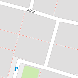
117 Afton
£ 90,000
Description
We don't have a Description for this property.
- Bedrooms
- 3
- Bathrooms
- 0

Leaflet © OpenStreetMap contributors
The heatmap indicates the level of crime in the area. The color of the heatmap indicates the crime severity and recency.
Metrics Year-on-Year
- Average area value
- 222,105.00 £Increased by 27.39 %
- Average area rental value
- 751.00 £/moDecreased by 24.90 %
- Est rental Yield
- 4.06 %Decreased by 40.99 %
- Crime Rate
- 13.00 %Unchanged by 0.00 %
from 174,349.00 £
from 1,000.00 £/mo
from 6.88 %
from 13.00 %
Nearby Schools
| Name | Type | Ofsted | Distance |
|---|---|---|---|
| St Basil'S Catholic Primary School | Voluntary Aided School | Good | 0.36 KM |
| St Michael With St Thomas Ce Primary School | Academy Converter | 0.62 KM | |
| Upton Children'S Centre | Children's Centre | 0.69 KM | |
| Oakfield Community Primary School | Community School | Good | 0.76 KM |
| All Saints Upton Church Of England Voluntary Controlled Primary School | Voluntary Controlled School | Requires improvement | 0.91 KM |
Images
Nearby Streets
| Name | Average Price | Average Sqft | Distance |
|---|---|---|---|
| Liverpool Road | £ 0 | 0 | 0.00 KM |
| Lancaster Avenue | £ 325,000 | 0 | 0.00 KM |
| Cherry Sutton | £ 0 | 0 | 0.00 KM |
| Danescroft | £ 0 | 0 | 0.00 KM |
| Rufford Close | £ 180,000 | 0 | 0.00 KM |
Nearby Transport
| Name | NLC | TLC | Distance |
|---|---|---|---|
| Hough Green | 2303 | HGN | 0.22 KM |
| Widnes | 2391 | WID | 4.74 KM |
| Rainhill | 2296 | RNH | 4.90 KM |
| Whiston | 2161 | WHN | 4.96 KM |
| Runcorn | 2291 | RUN | 5.67 KM |
Nearby Listings
| Address | Price | Type | Score | Distance |
|---|---|---|---|---|
| Afton, Widnes | £ 120,000 | BUY | 6 / 10 | 0.01 KM |
| Afton, Widnes | £ 145,000 | BUY | 6 / 10 | 0.01 KM |
| Arley Drive, Widnes, WA8 4XS | £ 145,000 | BUY | 7 / 10 | 0.13 KM |
| Afton, Widnes | £ 130,000 | BUY | 6 / 10 | 0.13 KM |
| Arley Drive, Widnes, WA8 | £ 130,000 | BUY | 7 / 10 | 0.14 KM |