UN
1 Downside
£ 130,000
Description
We don't have a Description for this property.
- Bedrooms
- 2
- Bathrooms
- 0
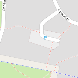

Leaflet © OpenStreetMap contributors
The heatmap indicates the level of crime in the area. The color of the heatmap indicates the crime severity and recency.
Metrics Year-on-Year
- Average area value
- 290,444.00 £Increased by 45.57 %
- Average area rental value
- 1,060.00 £/moIncreased by 29.74 %
- Est rental Yield
- 4.38 %Decreased by 10.79 %
- Crime Rate
- 8.00 %Unchanged by 0.00 %
from 199,519.00 £
from 817.00 £/mo
from 4.91 %
from 8.00 %
Nearby Schools
| Name | Type | Ofsted | Distance |
|---|---|---|---|
| All Saints Upton Church Of England Voluntary Controlled Primary School | Voluntary Controlled School | Requires improvement | 0.16 KM |
| Upton Children'S Centre | Children's Centre | 0.32 KM | |
| St Basil'S Catholic Primary School | Voluntary Aided School | Good | 0.78 KM |
| Oakfield Community Primary School | Community School | Good | 1.26 KM |
| Ormiston Chadwick Academy | Academy Sponsor Led | Outstanding | 1.35 KM |
Images
Nearby Streets
| Name | Average Price | Average Sqft | Distance |
|---|---|---|---|
| Danescroft | £ 0 | 0 | 0.00 KM |
| Rufford Close | £ 180,000 | 0 | 0.00 KM |
| Cherry Sutton | £ 0 | 0 | 0.00 KM |
| Liverpool Road | £ 0 | 0 | 0.00 KM |
| Appleby Close | £ 140,000 | 0 | 0.00 KM |
Nearby Transport
| Name | NLC | TLC | Distance |
|---|---|---|---|
| Hough Green | 2303 | HGN | 0.83 KM |
| Widnes | 2391 | WID | 4.04 KM |
| Rainhill | 2296 | RNH | 4.37 KM |
| Whiston | 2161 | WHN | 4.94 KM |
| Runcorn | 2291 | RUN | 5.54 KM |
Nearby Listings
| Address | Price | Type | Score | Distance |
|---|---|---|---|---|
| Eversley,Widnes,WA8 4XZ | £ 140,000 | BUY | 7 / 10 | 0.18 KM |
| Foxcote, Widnes, WA8 | £ 135,000 | BUY | 6 / 10 | 0.21 KM |
| Eversley, Widnes, WA8 | £ 175,000 | BUY | 7 / 10 | 0.29 KM |
| Arley Drive, Widnes, Cheshire, WA8 | £ 100,000 | BUY | Unknown | 0.30 KM |
| Arley Drive , Widnes, WA8 4YE | £ 135,000 | BUY | 6 / 10 | 0.31 KM |
Nearby Properties
| Address | Price | Distance |
|---|---|---|
| 68 Downside | £ 145,000 | 0.00 KM |
| 40 Downside | £ 73,000 | 0.00 KM |
| 54 Downside | £ 64,000 | 0.00 KM |
| 1 Downside | £ 130,000 | 0.00 KM |
| 28 Downside | £ 99,000 | 0.00 KM |