UN
2 Dalewood
£ 145,000
Description
We don't have a Description for this property.
- Bedrooms
- 3
- Bathrooms
- 0
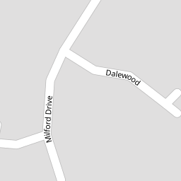

Leaflet © OpenStreetMap contributors
The heatmap indicates the level of crime in the area. The color of the heatmap indicates the crime severity and recency.
Metrics Year-on-Year
- Average area value
- 205,000.00 £Increased by 28.45 %
- Average area rental value
- 1,050.00 £/moIncreased by 6.60 %
- Est rental Yield
- 6.15 %Decreased by 17.00 %
- Crime Rate
- 9.00 %Unchanged by 0.00 %
from 159,590.00 £
from 985.00 £/mo
from 7.41 %
from 9.00 %
Nearby Schools
| Name | Type | Ofsted | Distance |
|---|---|---|---|
| Emmaus Church Of England And Catholic Primary School | Voluntary Aided School | Outstanding | 0.74 KM |
| Croxteth Community Primary School | Academy Sponsor Led | 1.25 KM | |
| Croxteth Children'S Centre | Children's Centre Linked Site | 1.88 KM | |
| St Albert'S Catholic Primary School | Voluntary Aided School | Good | 1.92 KM |
| Our Lady And St Swithin'S Catholic Primary School | Voluntary Aided School | Good | 1.97 KM |
Images
Nearby Streets
| Name | Average Price | Average Sqft | Distance |
|---|---|---|---|
| Saint Cuthbert's Close | £ 0 | 0 | 0.00 KM |
| Fir Tree Drive South | £ 0 | 0 | 0.00 KM |
| The Pines | £ 326,667 | 0 | 0.00 KM |
| Helford Road | £ 0 | 0 | 0.00 KM |
| Gelling's Lane | £ 2,500,000 | 0 | 0.00 KM |
Nearby Transport
| Name | NLC | TLC | Distance |
|---|---|---|---|
| Kirkby (Merseyside) | 2124 | KIR | 4.43 KM |
| Broad Green | 2240 | BGE | 5.04 KM |
| Roby | 2261 | ROB | 5.51 KM |
| Fazakerley | 2126 | FAZ | 6.15 KM |
| Huyton | 2160 | HUY | 6.46 KM |
Nearby Listings
| Address | Price | Type | Score | Distance |
|---|---|---|---|---|
| Milford Drive, Liverpool, L12 | £ 175,000 | BUY | Unknown | 0.06 KM |
| Milford Drive, Liverpool, Merseyside, L12 | £ 185,000 | BUY | Unknown | 0.07 KM |
| Ellerton Way, Liverpool | £ 100,000 | BUY | 5 / 10 | 0.08 KM |
| Ellerton Way, Croxteth Park, Liverpool, L12 | £ 160,000 | BUY | 5 / 10 | 0.08 KM |
| Abbotsbury Way, Liverpool | £ 190,000 | BUY | 7 / 10 | 0.14 KM |
Nearby Properties
| Address | Price | Distance |
|---|---|---|
| 2 Dalewood | £ 145,000 | 0.00 KM |
| 7 Dalewood | £ 54,950 | 0.00 KM |
| 8 Haddon Walk | £ 125,500 | 0.05 KM |
| 2 Haddon Walk | £ 182,000 | 0.05 KM |
| 6 Haddon Walk | £ 43,500 | 0.05 KM |