UN
13 Kew Road
£ 139,000
Description
We don't have a Description for this property.
- Bedrooms
- 2
- Bathrooms
- 0
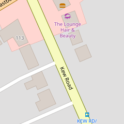

Leaflet © OpenStreetMap contributors
The heatmap indicates the level of crime in the area. The color of the heatmap indicates the crime severity and recency.
Metrics Year-on-Year
- Average area value
- 320,000.00 £Decreased by 1.71 %
- Average area rental value
- 8,975.00 £/moIncreased by 717.40 %
- Est rental Yield
- 33.66 %Increased by 731.11 %
- Crime Rate
- 5.00 %Unchanged by 0.00 %
from 325,557.00 £
from 1,098.00 £/mo
from 4.05 %
from 5.00 %
Nearby Schools
| Name | Type | Ofsted | Distance |
|---|---|---|---|
| Birkdale Primary School | Community School | Good | 0.35 KM |
| St Teresa'S Catholic Infant And Nursery School | Voluntary Aided School | Good | 0.37 KM |
| Christ The King Catholic High School And Sixth Form Centre | Voluntary Aided School | Requires improvement | 0.78 KM |
| Linaker Primary School | Community School | Requires improvement | 1.04 KM |
| Our Lady Of Lourdes Catholic Primary School | Voluntary Aided School | Good | 1.07 KM |
Images
Nearby Streets
| Name | Average Price | Average Sqft | Distance |
|---|---|---|---|
| College Close | £ 0 | 0 | 0.00 KM |
| The Walk | £ 195,000 | 0 | 0.00 KM |
| Birch Street | £ 142,500 | 0 | 0.00 KM |
| The Walk | £ 0 | 0 | 0.00 KM |
| Belgrave Place | £ 629,999 | 0 | 0.00 KM |
Nearby Transport
| Name | NLC | TLC | Distance |
|---|---|---|---|
| Birkdale | 2352 | BDL | 0.82 KM |
| Southport | 2262 | SOP | 1.95 KM |
| Hillside | 2231 | HIL | 2.02 KM |
| Meols Cop | 2357 | MEC | 4.02 KM |
| Ainsdale | 2350 | ANS | 4.91 KM |
Nearby Listings
| Address | Price | Type | Score | Distance |
|---|---|---|---|---|
| Brighton Road, Birkdale, Southport, Merseyside, PR8 4DD | £ 360,000 | BUY | 7 / 10 | 0.14 KM |
| Eastbourne Road, Southport | £ 320,000 | BUY | 7 / 10 | 0.15 KM |
| Claremont Road, Southport | £ 270,000 | BUY | 7 / 10 | 0.15 KM |
| Claremont Road Southport Southport | £ 95,000 | BUY | 6 / 10 | 0.19 KM |
| Bury Road, Birkdale, Southport, Merseyside, PR8 4EP | £ 195,000 | BUY | 6 / 10 | 0.19 KM |
Nearby Properties
| Address | Price | Distance |
|---|---|---|
| 39 Kew Road | £ 145,000 | 0.00 KM |
| 22 Kew Road | £ 150,000 | 0.00 KM |
| 24c Kew Road | £ 205,000 | 0.00 KM |
| 13 Kew Road | £ 139,000 | 0.00 KM |
| 12 Kew Road | £ 165,000 | 0.00 KM |