UN
7 Balls Place
£ 116,000
Description
We don't have a Description for this property.
- Bedrooms
- 2
- Bathrooms
- 0


Leaflet © OpenStreetMap contributors
The heatmap indicates the level of crime in the area. The color of the heatmap indicates the crime severity and recency.
Metrics Year-on-Year
- Average area value
- 337,276.00 £Decreased by 6.99 %
- Average area rental value
- 7,147.00 £/moIncreased by 653.90 %
- Est rental Yield
- 25.43 %Increased by 709.87 %
- Crime Rate
- 28.00 %Unchanged by 0.00 %
from 362,631.00 £
from 948.00 £/mo
from 3.14 %
from 28.00 %
Nearby Schools
| Name | Type | Ofsted | Distance |
|---|---|---|---|
| Southport College | Further Education | Good | 0.78 KM |
| Parenting 2000 Children'S Centre | Children's Centre Linked Site | 0.81 KM | |
| Linaker Children'S Centre | Children's Centre | 0.87 KM | |
| Linaker Primary School | Community School | Requires improvement | 0.90 KM |
| Arden College | Special Post 16 Institution | Good | 0.90 KM |
Images
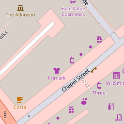
Nearby Streets
| Name | Average Price | Average Sqft | Distance |
|---|---|---|---|
| Wesley Street | £ 0 | 0 | 0.00 KM |
| Chapel Street | £ 0 | 0 | 0.00 KM |
| Bank Passage | £ 0 | 0 | 0.00 KM |
| Talbot Drive | £ 0 | 0 | 0.00 KM |
| Lord Street | £ 150,000 | 0 | 0.00 KM |
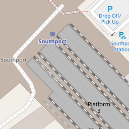
Nearby Transport
| Name | NLC | TLC | Distance |
|---|---|---|---|
| Southport | 2262 | SOP | 0.23 KM |
| Birkdale | 2352 | BDL | 1.71 KM |
| Meols Cop | 2357 | MEC | 3.15 KM |
| Hillside | 2231 | HIL | 3.45 KM |
| Ainsdale | 2350 | ANS | 6.44 KM |
Nearby Listings
| Address | Price | Type | Score | Distance |
|---|---|---|---|---|
| Market Street/Queen Anne Street, Southport, PR8 1 | £ 225,000 | BUY | Unknown | 0.18 KM |
| Market Street/Queen Anne Street, Southport, PR8 1 | £ 225,000 | BUY | Unknown | 0.18 KM |
| Talbot Street, Southport | £ 99,950 | BUY | 6 / 10 | 0.20 KM |
| Eastbank Street, Southport | £ 230,000 | BUY | Unknown | 0.21 KM |
| North House, Southport, PR8 | £ 55,000 | BUY | 7 / 10 | 0.22 KM |
Nearby Properties
| Address | Price | Distance |
|---|---|---|
| 4 Balls Place | £ 115,000 | 0.00 KM |
| 7 Balls Place | £ 116,000 | 0.00 KM |
| 8 Balls Place | £ 95,000 | 0.00 KM |
| 9 Balls Place | £ 105,000 | 0.00 KM |
| 20 Wesley Street | £ 90,000 | 0.04 KM |