UN
9 Catterick Fold
£ 164,000
Description
We don't have a Description for this property.
- Bedrooms
- 3
- Bathrooms
- 0
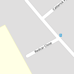

Leaflet © OpenStreetMap contributors
The heatmap indicates the level of crime in the area. The color of the heatmap indicates the crime severity and recency.
Metrics Year-on-Year
- Average area value
- 566,147.00 £Decreased by 10.07 %
- Average area rental value
- 3,400.00 £/moIncreased by 28.11 %
- Est rental Yield
- 7.21 %Increased by 42.49 %
- Crime Rate
- 13.00 %Unchanged by 0.00 %
from 629,523.00 £
from 2,654.00 £/mo
from 5.06 %
from 13.00 %
Nearby Schools
| Name | Type | Ofsted | Distance |
|---|---|---|---|
| Kew Woods Primary School | Academy Converter | 0.26 KM | |
| Meols Cop High School | Community School | Outstanding | 0.78 KM |
| Norwood Primary School | Community School | Good | 1.90 KM |
| Holy Family Catholic Primary School | Voluntary Aided School | Good | 2.00 KM |
| St Philip'S Church Of England Primary School | Voluntary Aided School | Good | 2.27 KM |
Images
Nearby Streets
| Name | Average Price | Average Sqft | Distance |
|---|---|---|---|
| Altham Road | £ 250,000 | 0 | 0.00 KM |
| Haig Avenue | £ 170,000 | 0 | 0.00 KM |
| Butts Lane | £ 0 | 0 | 0.00 KM |
| Woodhouse Close | £ 0 | 0 | 0.00 KM |
| Bramble Court | £ 0 | 0 | 0.00 KM |
Nearby Transport
| Name | NLC | TLC | Distance |
|---|---|---|---|
| Meols Cop | 2357 | MEC | 1.62 KM |
| Southport | 2262 | SOP | 3.46 KM |
| Birkdale | 2352 | BDL | 4.38 KM |
| Hillside | 2231 | HIL | 5.61 KM |
| Bescar Lane | 2351 | BES | 6.72 KM |
Nearby Listings
| Address | Price | Type | Score | Distance |
|---|---|---|---|---|
| Catterick Fold, Southport, Merseyside, PR8 | £ 190,000 | BUY | 6 / 10 | 0.02 KM |
| Cheltenham Way, Southport | £ 160,000 | BUY | Unknown | 0.10 KM |
| Cheltenham Way, Southport | £ 160,000 | BUY | Unknown | 0.10 KM |
| Cheltenham Way, Southport, PR8 | £ 200,000 | BUY | Unknown | 0.11 KM |
| Cheltenham Way, Kew, Southport | £ 195,000 | BUY | 6 / 10 | 0.12 KM |
Nearby Properties
| Address | Price | Distance |
|---|---|---|
| 12 Catterick Fold | £ 131,000 | 0.00 KM |
| 11 Catterick Fold | £ 50,000 | 0.00 KM |
| 18 Catterick Fold | £ 145,950 | 0.00 KM |
| 3 Catterick Fold | £ 51,000 | 0.00 KM |
| 14 Catterick Fold | £ 152,000 | 0.00 KM |