UN
31 Everard Road
£ 200,000
Description
We don't have a Description for this property.
- Bedrooms
- 4
- Bathrooms
- 0
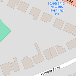

Leaflet © OpenStreetMap contributors
The heatmap indicates the level of crime in the area. The color of the heatmap indicates the crime severity and recency.
Metrics Year-on-Year
- Average area value
- 572,871.00 £Increased by 2.02 %
- Average area rental value
- 2,569.00 £/moDecreased by 19.32 %
- Est rental Yield
- 5.38 %Decreased by 20.88 %
- Crime Rate
- 3.00 %Unchanged by 0.00 %
from 561,536.00 £
from 3,184.00 £/mo
from 6.80 %
from 3.00 %
Nearby Schools
| Name | Type | Ofsted | Distance |
|---|---|---|---|
| St Philip'S Church Of England Primary School | Voluntary Aided School | Good | 1.03 KM |
| Kew Woods Primary School | Academy Converter | 1.13 KM | |
| Meols Cop High School | Community School | Outstanding | 1.24 KM |
| Norwood Primary School | Community School | Good | 1.48 KM |
| Holy Family Catholic Primary School | Voluntary Aided School | Good | 1.53 KM |
Images
Nearby Streets
| Name | Average Price | Average Sqft | Distance |
|---|---|---|---|
| Pilkington Road | £ 280,000 | 0 | 0.00 KM |
| Princes Gardens | £ 60,000 | 0 | 0.00 KM |
| Tithebarn Road | £ 120,000 | 0 | 0.00 KM |
| Bramble Court | £ 0 | 0 | 0.00 KM |
| Willow Grove | £ 0 | 0 | 0.00 KM |
Nearby Transport
| Name | NLC | TLC | Distance |
|---|---|---|---|
| Meols Cop | 2357 | MEC | 1.53 KM |
| Southport | 2262 | SOP | 2.22 KM |
| Birkdale | 2352 | BDL | 3.23 KM |
| Hillside | 2231 | HIL | 4.63 KM |
| Ainsdale | 2350 | ANS | 7.39 KM |
Nearby Listings
| Address | Price | Type | Score | Distance |
|---|---|---|---|---|
| Everard Road, Southport, PR8 | £ 250,000 | BUY | Unknown | 0.00 KM |
| Ashdown Close, Southport | £ 295,000 | BUY | 7 / 10 | 0.11 KM |
| Loxley Road, Southport | £ 159,950 | BUY | 6 / 10 | 0.12 KM |
| Broughton Avenue, Southport, PR8 | £ 315,000 | BUY | Unknown | 0.13 KM |
| Scarisbrick New Road, Southport, PR8 6LQ | £ 475,000 | BUY | 8 / 10 | 0.14 KM |
Nearby Properties
| Address | Price | Distance |
|---|---|---|
| 1 Everard Road | £ 249,950 | 0.00 KM |
| 17 Everard Road | £ 123,000 | 0.00 KM |
| 15 Everard Road | £ 160,000 | 0.00 KM |
| 7 Everard Road | £ 180,000 | 0.00 KM |
| 31 Everard Road | £ 200,000 | 0.00 KM |