UN
45 Eastway
£ 211,000
Description
We don't have a Description for this property.
- Bedrooms
- 3
- Bathrooms
- 0
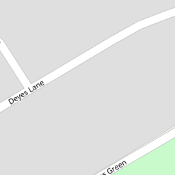

Leaflet © OpenStreetMap contributors
The heatmap indicates the level of crime in the area. The color of the heatmap indicates the crime severity and recency.
Metrics Year-on-Year
- Average area value
- 277,783.00 £Increased by 15.36 %
- Average area rental value
- 1,091.00 £/moDecreased by 0.91 %
- Est rental Yield
- 4.71 %Decreased by 14.21 %
- Crime Rate
- 11.00 %Unchanged by 0.00 %
from 240,798.00 £
from 1,101.00 £/mo
from 5.49 %
from 11.00 %
Nearby Schools
| Name | Type | Ofsted | Distance |
|---|---|---|---|
| Northway Primary School | Community School | Good | 0.56 KM |
| Deyes High School | Academy Converter | Good | 0.64 KM |
| St Andrews Church Of England Primary School, Maghull | Academy Converter | 0.64 KM | |
| Maricourt Catholic High School | Voluntary Aided School | Requires improvement | 0.94 KM |
| St Thomas Church Of England Primary School, Lydiate | Academy Converter | 1.11 KM |
Images
Nearby Streets
| Name | Average Price | Average Sqft | Distance |
|---|---|---|---|
| Langdale Drive | £ 315,000 | 0 | 0.00 KM |
| Twyford Close | £ 0 | 0 | 0.00 KM |
| Laburnum Grove | £ 0 | 0 | 0.00 KM |
| Matthew Lock Way | £ 110,000 | 0 | 0.00 KM |
| The Meadows | £ 0 | 0 | 0.00 KM |
Nearby Transport
| Name | NLC | TLC | Distance |
|---|---|---|---|
| Maghull | 2155 | MAG | 1.10 KM |
| Maghull North | 6576 | MNS | 1.50 KM |
| Old Roan | 2258 | ORN | 3.65 KM |
| Town Green | 2283 | TWN | 4.52 KM |
| Kirkby (Merseyside) | 2124 | KIR | 4.81 KM |
Nearby Listings
| Address | Price | Type | Score | Distance |
|---|---|---|---|---|
| Kendal Drive, Maghull | £ 250,000 | BUY | 5 / 10 | 0.09 KM |
| Kendal Drive, Maghull | £ 260,000 | BUY | 8 / 10 | 0.15 KM |
| Deyes Lane, Liverpool, L31 | £ 250,000 | BUY | Unknown | 0.17 KM |
| Coniston Road, Maghull | £ 235,000 | BUY | 6 / 10 | 0.21 KM |
| Eskdale Drive, Maghull, Liverpool, Merseyside, L31 | £ 400,000 | BUY | Unknown | 0.22 KM |
Nearby Properties
| Address | Price | Distance |
|---|---|---|
| 88 Eastway | £ 199,950 | 0.00 KM |
| 89 Eastway | £ 165,000 | 0.00 KM |
| 83 Eastway | £ 155,000 | 0.00 KM |
| 60 Eastway | £ 77,000 | 0.00 KM |
| 50 Eastway | £ 187,000 | 0.00 KM |