UN
6 Breck Road
£ 201,050
Description
We don't have a Description for this property.
- Bedrooms
- 5
- Bathrooms
- 0

Leaflet © OpenStreetMap contributors
The heatmap indicates the level of crime in the area. The color of the heatmap indicates the crime severity and recency.
Metrics Year-on-Year
- Average area value
- 384,983.00 £Increased by 41.93 %
- Average area rental value
- 1,109.00 £/moDecreased by 13.49 %
- Est rental Yield
- 3.46 %Decreased by 38.98 %
- Crime Rate
- 7.00 %Unchanged by 0.00 %
from 271,244.00 £
from 1,282.00 £/mo
from 5.67 %
from 7.00 %
Nearby Schools
| Name | Type | Ofsted | Distance |
|---|---|---|---|
| Woodlands School | Community Special School | Good | 0.39 KM |
| St Kentigern'S Catholic Primary School | Voluntary Aided School | Good | 0.43 KM |
| Park Community Academy | Academy Special Converter | Outstanding | 0.44 KM |
| The Together Centre | Children's Centre Linked Site | 0.47 KM | |
| Tower Learning Centre | Other Independent School | 0.77 KM |
Images
Nearby Streets
| Name | Average Price | Average Sqft | Distance |
|---|---|---|---|
| Myrtle Avenue | £ 0 | 0 | 0.00 KM |
| Springfield Court | £ 99,950 | 0 | 0.00 KM |
| Palatine Road | £ 124,142 | 0 | 0.00 KM |
| The Elms | £ 110,000 | 0 | 0.00 KM |
| Hillside Close | £ 0 | 0 | 0.00 KM |
Nearby Transport
| Name | NLC | TLC | Distance |
|---|---|---|---|
| Blackpool North | 2739 | BPN | 1.84 KM |
| Layton (Lancs) | 2669 | LAY | 2.30 KM |
| Blackpool South | 2740 | BPS | 2.44 KM |
| Blackpool Pleasure Beach | 2738 | BPB | 3.72 KM |
| Squires Gate | 2666 | SQU | 4.55 KM |
Nearby Listings
| Address | Price | Type | Score | Distance |
|---|---|---|---|---|
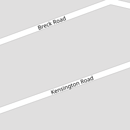
| Breck Road, Blackpool, FY3 | £ 180,000 | BUY | Unknown | 0.04 KM |
| Kensington Road, Blackpool | £ 145,000 | BUY | Unknown | 0.05 KM |
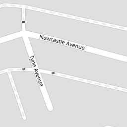
| Newcastle Avenue, Blackpool, FY3 | £ 50,000 | BUY | Unknown | 0.07 KM |
| Newcastle Avenue, Blackpool, Lancashire, FY3 | £ 99,950 | BUY | Unknown | 0.07 KM |
| Newcastle Avenue, Blackpool, Lancashire, FY3 | £ 99,950 | BUY | Unknown | 0.07 KM |
Nearby Properties
| Address | Price | Distance |
|---|---|---|
| 2 Breck Road | £ 92,000 | 0.00 KM |
| 23 Breck Road | £ 100,000 | 0.00 KM |
| 17 Breck Road | £ 105,000 | 0.00 KM |
| 30 Breck Road | £ 108,000 | 0.00 KM |
| 42 Breck Road | £ 80,000 | 0.00 KM |