UN
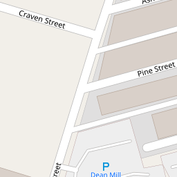
4 Pine Street
£ 50,000
Description
We don't have a Description for this property.
- Bedrooms
- 2
- Bathrooms
- 0
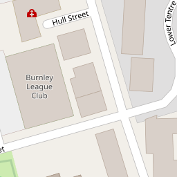

Leaflet © OpenStreetMap contributors
The heatmap indicates the level of crime in the area. The color of the heatmap indicates the crime severity and recency.
Metrics Year-on-Year
- Average area value
- 85,704.00 £Decreased by 9.45 %
- Average area rental value
- 535.00 £/moIncreased by 11.92 %
- Est rental Yield
- 7.49 %Increased by 23.60 %
- Crime Rate
- 15.00 %Unchanged by 0.00 %
from 94,651.00 £
from 478.00 £/mo
from 6.06 %
from 15.00 %
Nearby Schools
| Name | Type | Ofsted | Distance |
|---|---|---|---|
| Burnley Springfield Community Primary School | Community School | Good | 0.40 KM |
| Burnley Wood Children'S Centre | Children's Centre | 0.50 KM | |
| Burnley St Peter'S Church Of England Primary School | Voluntary Aided School | Good | 0.58 KM |
| St Mary'S Roman Catholic Primary School, Burnley | Voluntary Aided School | Requires improvement | 0.81 KM |
| Burnley St Stephen'S Church Of England Voluntary Aided Primary School | Voluntary Aided School | Good | 0.92 KM |
Images
Nearby Streets
| Name | Average Price | Average Sqft | Distance |
|---|---|---|---|
| Craven Street | £ 0 | 0 | 0.00 KM |
| Kay Gardens | £ 0 | 0 | 0.00 KM |
| Lyndhurst Road | £ 0 | 0 | 0.00 KM |
| Robinson Street | £ 0 | 0 | 0.00 KM |
| Higgin Street | £ 0 | 0 | 0.00 KM |
Nearby Transport
| Name | NLC | TLC | Distance |
|---|---|---|---|
| Burnley Central | 2550 | BNC | 1.23 KM |
| Burnley Manchester Road | 2549 | BYM | 1.46 KM |
| Burnley Barracks | 2743 | BUB | 2.50 KM |
| Brierfield | 2554 | BRF | 4.10 KM |
| Rose Grove | 2722 | RSG | 5.20 KM |
Nearby Listings
| Address | Price | Type | Score | Distance |
|---|---|---|---|---|
| 11 Pine Street, Burnley, Lancashire, BB11 3AE | £ 40,000 | BUY | 5 / 10 | 0.01 KM |
| 11 Pine Street, Burnley, Lancashire, BB11 3AE | £ 40,000 | BUY | Unknown | 0.01 KM |
| Pine Street, Burnley, BB11 | £ 32,500 | BUY | Unknown | 0.01 KM |
| Branch Road, Burnley | £ 77,500 | BUY | 6 / 10 | 0.29 KM |
| Albert Street, Burnley | £ 59,950 | BUY | 5 / 10 | 0.33 KM |
Nearby Properties
| Address | Price | Distance |
|---|---|---|
| 17 Pine Street | £ 49,000 | 0.00 KM |
| 8 Pine Street | £ 48,000 | 0.00 KM |
| 2 Pine Street | £ 44,000 | 0.00 KM |
| 22 Pine Street | £ 42,000 | 0.00 KM |
| 11 Pine Street | £ 60,000 | 0.00 KM |