UN
3 Sherwood Way
£ 133,750
Description
We don't have a Description for this property.
- Bedrooms
- 2
- Bathrooms
- 0
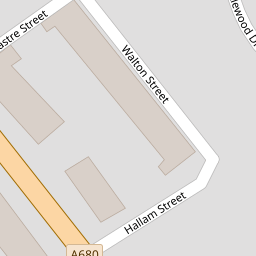

Leaflet © OpenStreetMap contributors
The heatmap indicates the level of crime in the area. The color of the heatmap indicates the crime severity and recency.
Metrics Year-on-Year
- Average area value
- 208,458.00 £Increased by 22.40 %
- Average area rental value
- 838.00 £/moIncreased by 13.09 %
- Est rental Yield
- 4.82 %Decreased by 7.66 %
- Crime Rate
- 6.00 %Unchanged by 0.00 %
from 170,306.00 £
from 741.00 £/mo
from 5.22 %
from 6.00 %
Nearby Schools
| Name | Type | Ofsted | Distance |
|---|---|---|---|
| Accrington Academy | Academy Sponsor Led | Good | 0.71 KM |
| Accrington St Christopher'S Church Of England High School | Academy Converter | Good | 0.84 KM |
| Clayton-Le-Moors Mount Pleasant Primary School | Community School | Outstanding | 1.04 KM |
| Sure Start Hyndburn - Church & West Accrington Childrens Centre | Children's Centre | 1.19 KM | |
| St Mary'S Roman Catholic Primary School, Clayton-Le-Moors | Voluntary Aided School | Good | 1.20 KM |
Images
Nearby Streets
| Name | Average Price | Average Sqft | Distance |
|---|---|---|---|
| Cleveleys Road | £ 199,950 | 0 | 0.00 KM |
| William Street | £ 0 | 0 | 0.00 KM |
| Hill Street | £ 0 | 0 | 0.00 KM |
| West Crescent | £ 90,000 | 0 | 0.00 KM |
| Cromwell Street | £ 0 | 0 | 0.00 KM |
Nearby Transport
| Name | NLC | TLC | Distance |
|---|---|---|---|
| Accrington | 2552 | ACR | 1.72 KM |
| Church And Oswaldtwistle | 2556 | CTW | 2.73 KM |
| Huncoat | 2558 | HCT | 2.93 KM |
| Rishton | 2580 | RIS | 5.15 KM |
| Hapton | 2557 | HPN | 6.47 KM |
Nearby Listings
| Address | Price | Type | Score | Distance |
|---|---|---|---|---|
| Whalley Road, Altham West, Accrington | £ 159,950 | BUY | Unknown | 0.12 KM |
| Ringwood Close, Accrington, BB5 | £ 260,000 | BUY | 7 / 10 | 0.20 KM |
| Tunstall Drive, Accrington | £ 179,950 | BUY | 7 / 10 | 0.25 KM |
| Whalley Road, Clayton Le Moors, Accrington | £ 110,000 | BUY | 6 / 10 | 0.26 KM |
| Whalley Road, Accrington, Lancashire, BB5 | £ 330,000 | BUY | 6 / 10 | 0.30 KM |
Nearby Properties
| Address | Price | Distance |
|---|---|---|
| 5 Sherwood Way | £ 54,500 | 0.00 KM |
| 7 Sherwood Way | £ 105,000 | 0.00 KM |
| 8 Sherwood Way | £ 145,000 | 0.00 KM |
| 4 Sherwood Way | £ 125,000 | 0.00 KM |
| 2 Sherwood Way | £ 47,000 | 0.00 KM |