UN
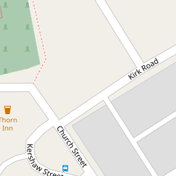
19 Kirk Road
£ 77,000
Description
We don't have a Description for this property.
- Bedrooms
- 2
- Bathrooms
- 0


Leaflet © OpenStreetMap contributors
The heatmap indicates the level of crime in the area. The color of the heatmap indicates the crime severity and recency.
Metrics Year-on-Year
- Average area value
- 261,822.00 £Decreased by 14.93 %
- Average area rental value
- 1,072.00 £/moIncreased by 3.57 %
- Est rental Yield
- 4.91 %Increased by 21.53 %
- Crime Rate
- 9.00 %Unchanged by 0.00 %
from 307,765.00 £
from 1,035.00 £/mo
from 4.04 %
from 9.00 %
Nearby Schools
| Name | Type | Ofsted | Distance |
|---|---|---|---|
| Sacred Heart Roman Catholic Primary School, Church | Voluntary Aided School | Requires improvement | 0.68 KM |
| St Nicholas Church Of England Primary School | Voluntary Aided School | Good | 0.82 KM |
| Oswaldtwistle St Paul'S Church Of England Primary School | Voluntary Aided School | Good | 1.12 KM |
| Oswaldtwistle School | Pupil Referral Unit | Good | 1.12 KM |
| St Mary'S Roman Catholic Primary School, Oswaldtwistle | Voluntary Aided School | Good | 1.50 KM |
Images
Nearby Streets
| Name | Average Price | Average Sqft | Distance |
|---|---|---|---|
| Saint James Mews | £ 134,950 | 0 | 0.00 KM |
| Princess Street | £ 100,000 | 0 | 0.00 KM |
| Peel Bank | £ 200,000 | 0 | 0.00 KM |
| Newark Street | £ 0 | 0 | 0.00 KM |
| Pearl Street | £ 0 | 0 | 0.00 KM |
Nearby Transport
| Name | NLC | TLC | Distance |
|---|---|---|---|
| Church And Oswaldtwistle | 2556 | CTW | 0.75 KM |
| Accrington | 2552 | ACR | 2.56 KM |
| Rishton | 2580 | RIS | 3.16 KM |
| Huncoat | 2558 | HCT | 5.21 KM |
| Whalley (Lancashire) | 2736 | WHE | 7.75 KM |
Nearby Listings
| Address | Price | Type | Score | Distance |
|---|---|---|---|---|
| Kirk Road, Church, BB5 | £ 75,000 | BUY | 5 / 10 | 0.02 KM |
| John Street, Church, Accrington | £ 85,000 | BUY | 6 / 10 | 0.07 KM |
| York Street, Church, BB5 | £ 70,000 | BUY | 5 / 10 | 0.15 KM |
| Canal Street, Church, BB5 | £ 70,000 | BUY | 5 / 10 | 0.18 KM |
| Lion Street, Church, Accrington, Lancashire, BB5 | £ 95,000 | BUY | 7 / 10 | 0.19 KM |
Nearby Properties
| Address | Price | Distance |
|---|---|---|
| 29 Kirk Road | £ 19,000 | 0.00 KM |
| 9 Kirk Road | £ 39,999 | 0.00 KM |
| 5 Kirk Road | £ 30,000 | 0.00 KM |
| 11 Kirk Road | £ 59,000 | 0.00 KM |
| 17 Kirk Road | £ 25,000 | 0.00 KM |