UN
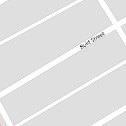
11a Bold Street
£ 20,000
Description
We don't have a Description for this property.
- Bedrooms
- 2
- Bathrooms
- 0


Leaflet © OpenStreetMap contributors
The heatmap indicates the level of crime in the area. The color of the heatmap indicates the crime severity and recency.
Metrics Year-on-Year
- Average area value
- 95,625.00 £Increased by 14.72 %
- Average area rental value
- 658.00 £/moIncreased by 7.69 %
- Est rental Yield
- 8.26 %Decreased by 6.14 %
- Crime Rate
- 19.00 %Unchanged by 0.00 %
from 83,358.00 £
from 611.00 £/mo
from 8.80 %
from 19.00 %
Nearby Schools
| Name | Type | Ofsted | Distance |
|---|---|---|---|
| Accrington Benjamin Hargreaves Voluntary Aided Church Of England Primary School | Voluntary Aided School | Good | 0.39 KM |
| Accrington St John With St Augustine Church Of England Primary School | Voluntary Aided School | Good | 0.53 KM |
| Accrington Peel Park Primary School | Foundation School | Outstanding | 0.59 KM |
| Heathland Private School | Other Independent School | 0.74 KM | |
| Lee Royd Nursery School | Local Authority Nursery School | Good | 0.82 KM |
Images
Nearby Streets
| Name | Average Price | Average Sqft | Distance |
|---|---|---|---|
| Penny House Lane | £ 100,000 | 0 | 0.00 KM |
| Whalley Road | £ 0 | 0 | 0.00 KM |
| Surrey Street | £ 0 | 0 | 0.00 KM |
| Pollard Street | £ 0 | 0 | 0.00 KM |
| Appleby CLose | £ 230,000 | 0 | 0.00 KM |
Nearby Transport
| Name | NLC | TLC | Distance |
|---|---|---|---|
| Accrington | 2552 | ACR | 1.19 KM |
| Huncoat | 2558 | HCT | 2.35 KM |
| Church And Oswaldtwistle | 2556 | CTW | 3.60 KM |
| Hapton | 2557 | HPN | 5.57 KM |
| Rishton | 2580 | RIS | 6.88 KM |
Nearby Listings
| Address | Price | Type | Score | Distance |
|---|---|---|---|---|
| Bold Street, Accrington | £ 115,000 | BUY | 5 / 10 | 0.01 KM |
| Bold Street, Accrington, Lancashire, BB5 | £ 100,000 | BUY | 6 / 10 | 0.01 KM |
| Stanley Street, Accrington | £ 95,000 | BUY | Unknown | 0.12 KM |
| Stanley Street, Accrington | £ 60,000 | BUY | 4 / 10 | 0.12 KM |
| Cedar Street, Accrington, Lancashire, BB5 | £ 90,000 | BUY | 4 / 10 | 0.12 KM |
Nearby Properties
| Address | Price | Distance |
|---|---|---|
| 40 Bold Street | £ 70,000 | 0.00 KM |
| 52 Bold Street | £ 63,500 | 0.00 KM |
| 7a Bold Street | £ 40,000 | 0.00 KM |
| 54 Bold Street | £ 64,500 | 0.00 KM |
| 44 Bold Street | £ 36,000 | 0.00 KM |