UN
4 Church Road
£ 63,000
Description
We don't have a Description for this property.
- Bedrooms
- 2
- Bathrooms
- 0
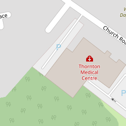


Leaflet © OpenStreetMap contributors
The heatmap indicates the level of crime in the area. The color of the heatmap indicates the crime severity and recency.
Metrics Year-on-Year
- Average area value
- 194,181.00 £Decreased by 8.20 %
- Average area rental value
- 775.00 £/moDecreased by 1.65 %
- Est rental Yield
- 4.79 %Increased by 7.16 %
- Crime Rate
- 3.00 %Unchanged by 0.00 %
from 211,525.00 £
from 788.00 £/mo
from 4.47 %
from 3.00 %
Nearby Schools
| Name | Type | Ofsted | Distance |
|---|---|---|---|
| Thornton Cleveleys Royles Brook Primary School | Community School | Good | 0.36 KM |
| Sacred Heart Catholic Primary School, Thornton Cleveleys | Voluntary Aided School | Good | 0.75 KM |
| Great Arley School | Community Special School | Good | 0.96 KM |
| Thornton-Cleveleys Red Marsh School | Community Special School | Outstanding | 1.05 KM |
| Thornton Primary School | Community School | Good | 1.17 KM |
Images
Nearby Streets
| Name | Average Price | Average Sqft | Distance |
|---|---|---|---|
| Millfield Court | £ 0 | 0 | 0.00 KM |
| Mill Close | £ 174,975 | 0 | 0.00 KM |
| The Chase | £ 0 | 0 | 0.00 KM |
| Calder Avenue | £ 0 | 0 | 0.00 KM |
| Burrstone Grange | £ 170,000 | 0 | 0.00 KM |
Nearby Transport
| Name | NLC | TLC | Distance |
|---|---|---|---|
| Poulton-Le-Fylde | 2671 | PFY | 4.12 KM |
| Layton (Lancs) | 2669 | LAY | 4.91 KM |
| Blackpool North | 2739 | BPN | 7.20 KM |
| Blackpool South | 2740 | BPS | 9.47 KM |
Nearby Listings
| Address | Price | Type | Score | Distance |
|---|---|---|---|---|
| Gaskell Crescent, Thornton, FY5 | £ 150,000 | BUY | 5 / 10 | 0.12 KM |
| Waring Drive, Thornton, FY5 | £ 119,950 | BUY | 4 / 10 | 0.22 KM |
| Waring Drive, Thornton-Cleveleys, FY5 | £ 164,950 | BUY | 7 / 10 | 0.23 KM |
| WARING DRIVE - THORNTON CLEVELEYS - FY5 2SW | £ 150,000 | BUY | 6 / 10 | 0.23 KM |
| Marsh Road, Thornton-Cleveleys, FY5 | £ 210,000 | BUY | 7 / 10 | 0.24 KM |
Nearby Properties
| Address | Price | Distance |
|---|---|---|
| 103 Marsh Road | £ 76,000 | 0.00 KM |
| 2a Church Road | £ 185,000 | 0.00 KM |
| 8 Church Road | £ 280,000 | 0.00 KM |
| 6 Church Road | £ 90,000 | 0.00 KM |
| 2b Church Road | £ 131,000 | 0.00 KM |