UN
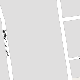
2 Inglewood Close
£ 92,500
Description
We don't have a Description for this property.
- Bedrooms
- 2
- Bathrooms
- 0


Leaflet © OpenStreetMap contributors
The heatmap indicates the level of crime in the area. The color of the heatmap indicates the crime severity and recency.
Metrics Year-on-Year
- Average area value
- 273,590.00 £Decreased by 34.35 %
- Average area rental value
- 1,148.00 £/moIncreased by 9.23 %
- Est rental Yield
- 5.04 %Increased by 66.34 %
- Crime Rate
- 1.00 %Unchanged by 0.00 %
from 416,742.00 £
from 1,051.00 £/mo
from 3.03 %
from 1.00 %
Nearby Schools
| Name | Type | Ofsted | Distance |
|---|---|---|---|
| West View Children'S Centre | Children's Centre | 0.81 KM | |
| Larkholme Primary School | Community School | Good | 0.93 KM |
| Charles Saer Community Primary School | Community School | Good | 0.98 KM |
| Cardinal Allen Catholic High School, Fleetwood | Voluntary Aided School | Good | 1.21 KM |
| Fleetwood High School | Foundation School | Requires improvement | 1.30 KM |
Images
Nearby Streets
| Name | Average Price | Average Sqft | Distance |
|---|---|---|---|
| Burnside Avenue | £ 0 | 0 | 0.00 KM |
| Greendale Close | £ 0 | 0 | 0.00 KM |
| Princes Way | £ 285,000 | 0 | 0.00 KM |
| Holme Avenue | £ 270,000 | 0 | 0.00 KM |
| Tarn Court | £ 225,000 | 0 | 0.00 KM |
Nearby Transport
| Name | NLC | TLC | Distance |
|---|---|---|---|
| Layton (Lancs) | 2669 | LAY | 8.30 KM |
| Poulton-Le-Fylde | 2671 | PFY | 9.05 KM |
| Blackpool North | 2739 | BPN | 9.59 KM |
Nearby Listings
| Address | Price | Type | Score | Distance |
|---|---|---|---|---|
| Inglewood Close, Fleetwood, FY7 | £ 195,000 | BUY | 7 / 10 | 0.00 KM |
| LARKHOLME PARADE - FLEETWOOD - FY7 8QY | £ 150,000 | BUY | Unknown | 0.09 KM |
| Buttermere Avenue, Fleetwood, Wyre, FY7 | £ 180,000 | BUY | Unknown | 0.11 KM |
| FERN COURT - ROSSALL - FLEETWOOD - FY7 8PD | £ 165,000 | BUY | 7 / 10 | 0.12 KM |
| Bowness Avenue, Fleetwood, FY7 | £ 189,950 | BUY | 6 / 10 | 0.24 KM |
Nearby Properties
| Address | Price | Distance |
|---|---|---|
| 3 Inglewood Close | £ 110,000 | 0.00 KM |
| 22 Inglewood Close | £ 120,000 | 0.00 KM |
| 8 Inglewood Close | £ 110,000 | 0.00 KM |
| 23 Inglewood Close | £ 130,000 | 0.00 KM |
| 29 Inglewood Close | £ 130,000 | 0.00 KM |