UN
1 Hans Road
£ 80,000
Description
We don't have a Description for this property.
- Bedrooms
- 2
- Bathrooms
- 0
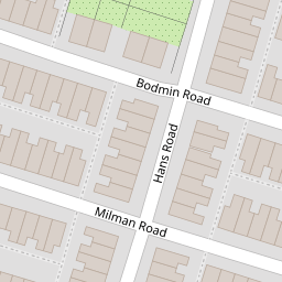


Leaflet © OpenStreetMap contributors
The heatmap indicates the level of crime in the area. The color of the heatmap indicates the crime severity and recency.
Metrics Year-on-Year
- Average area value
- 118,253.00 £Increased by 19.84 %
- Average area rental value
- 742.00 £/moDecreased by 6.43 %
- Est rental Yield
- 7.53 %Decreased by 21.89 %
- Crime Rate
- 11.00 %Unchanged by 0.00 %
from 98,675.00 £
from 793.00 £/mo
from 9.64 %
from 11.00 %
Nearby Schools
| Name | Type | Ofsted | Distance |
|---|---|---|---|
| Gwladys Street Primary And Nursery School | Community School | Good | 0.17 KM |
| Arnot St Mary Cofe Primary School | Voluntary Controlled School | Good | 0.53 KM |
| County & Walton Children'S Centre | Children's Centre | 0.55 KM | |
| Alsop High School | Academy Sponsor Led | 0.66 KM | |
| Everton Free School | Free Schools Alternative Provision | Good | 0.73 KM |
Images
Nearby Streets
| Name | Average Price | Average Sqft | Distance |
|---|---|---|---|
| St Mary's Avenue | £ 0 | 0 | 0.00 KM |
| Elm Road | £ 0 | 0 | 0.00 KM |
| Heathcote Road | £ 0 | 0 | 0.00 KM |
| Beech Road | £ 133,750 | 0 | 0.00 KM |
| Drayton Road | £ 75,000 | 0 | 0.00 KM |
Nearby Transport
| Name | NLC | TLC | Distance |
|---|---|---|---|
| Walton (Merseyside) | 2251 | WAO | 1.72 KM |
| Kirkdale | 2245 | KKD | 1.89 KM |
| Rice Lane | 2131 | RIL | 1.89 KM |
| Orrell Park | 2247 | OPK | 2.34 KM |
| Bank Hall | 2238 | BAH | 2.62 KM |
Nearby Listings
| Address | Price | Type | Score | Distance |
|---|---|---|---|---|
| Hans Road, Walton, Liverpool | £ 130,000 | BUY | Unknown | 0.06 KM |
| Cowley Road, Liverpool, Merseyside, L4 | £ 110,000 | BUY | Unknown | 0.07 KM |
| Cowley Road, Liverpool, Merseyside, L4 | £ 110,000 | BUY | 4 / 10 | 0.08 KM |
| Milman Road, Liverpool, L4 | £ 110,000 | BUY | Unknown | 0.09 KM |
| Bardsay Road, Liverpool, Merseyside, L4 | £ 90,000 | BUY | 4 / 10 | 0.09 KM |
Nearby Properties
| Address | Price | Distance |
|---|---|---|
| 11 Hans Road | £ 65,000 | 0.00 KM |
| 8 Hans Road | £ 65,000 | 0.00 KM |
| 21 Hans Road | £ 110,000 | 0.00 KM |
| 14 Hans Road | £ 77,500 | 0.00 KM |
| 30 Hans Road | £ 56,000 | 0.00 KM |