UN
3 Ashfield
£ 88,000
Description
We don't have a Description for this property.
- Bedrooms
- 2
- Bathrooms
- 0

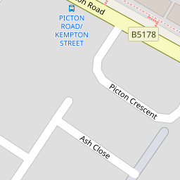

Leaflet © OpenStreetMap contributors
The heatmap indicates the level of crime in the area. The color of the heatmap indicates the crime severity and recency.
Metrics Year-on-Year
- Average area value
- 140,160.00 £Decreased by 3.95 %
- Average area rental value
- 483.00 £/moDecreased by 8.17 %
- Est rental Yield
- 4.14 %Decreased by 4.39 %
- Crime Rate
- 7.00 %Unchanged by 0.00 %
from 145,918.00 £
from 526.00 £/mo
from 4.33 %
from 7.00 %
Nearby Schools
| Name | Type | Ofsted | Distance |
|---|---|---|---|
| Lawrence Community Primary School | Community School | Requires improvement | 0.32 KM |
| St Hugh'S Catholic Primary School | Voluntary Aided School | Good | 0.63 KM |
| St Clare'S Catholic Primary School | Voluntary Aided School | Good | 0.65 KM |
| Heygreen Primary School | Academy Sponsor Led | Good | 0.75 KM |
| Chatham Place Nursery School | Local Authority Nursery School | Good | 0.90 KM |
Images
Nearby Streets
| Name | Average Price | Average Sqft | Distance |
|---|---|---|---|
| Ash Vale | £ 0 | 0 | 0.00 KM |
| Ormsby Street | £ 0 | 0 | 0.00 KM |
| Liberty Street | £ 0 | 0 | 0.00 KM |
| Bisley Street | £ 170,000 | 0 | 0.00 KM |
| Garmoyle Road | £ 0 | 0 | 0.00 KM |
Nearby Transport
| Name | NLC | TLC | Distance |
|---|---|---|---|
| Edge Hill | 2169 | EDG | 1.35 KM |
| Wavertree Technology Park | 8589 | WAV | 1.41 KM |
| Mossley Hill | 2171 | MSH | 3.14 KM |
| St Michaels | 2248 | STM | 3.38 KM |
| Aigburth | 2255 | AIG | 4.01 KM |
Nearby Listings
| Address | Price | Type | Score | Distance |
|---|---|---|---|---|
| Ashfield, Liverpool, L15 | £ 180,000 | BUY | 5 / 10 | 0.01 KM |
| Ashfield Road, Liverpool | £ 450,000 | BUY | 5 / 10 | 0.06 KM |
| Ash Grove, Wavertree, L15 | £ 160,000 | BUY | 6 / 10 | 0.07 KM |
| Ash Grove, Wavertree | £ 154,950 | BUY | Unknown | 0.08 KM |
| Ash Grove, Wavertree, Liverpool, Merseyside, L15 | £ 130,000 | BUY | 5 / 10 | 0.09 KM |
Nearby Properties
| Address | Price | Distance |
|---|---|---|
| 53 Ashfield | £ 100,000 | 0.00 KM |
| 27 Ashfield | £ 190,000 | 0.00 KM |
| 47 Ashfield | £ 114,000 | 0.00 KM |
| 39 Ashfield | £ 124,950 | 0.00 KM |
| 1 Ashfield | £ 55,000 | 0.00 KM |