UN
5 Stourton Road
£ 258,000
Description
We don't have a Description for this property.
- Bedrooms
- 4
- Bathrooms
- 0
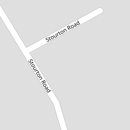


Leaflet © OpenStreetMap contributors
The heatmap indicates the level of crime in the area. The color of the heatmap indicates the crime severity and recency.
Metrics Year-on-Year
- Average area value
- 350,455.00 £Increased by 5.50 %
- Average area rental value
- 10,875.00 £/moIncreased by 953.78 %
- Est rental Yield
- 37.24 %Increased by 898.39 %
- Crime Rate
- 0.00 %
from 332,171.00 £
from 1,032.00 £/mo
from 3.73 %
from 0.00 %
Nearby Schools
| Name | Type | Ofsted | Distance |
|---|---|---|---|
| Ainsdale St John'S Church Of England Primary School | Voluntary Aided School | Outstanding | 0.56 KM |
| Kings Meadow Primary School And Early Years Education Centre | Community School | Good | 0.79 KM |
| Kings Meadow Children'S Centre | Children's Centre Linked Site | 0.79 KM | |
| Merefield School | Community Special School | Outstanding | 1.27 KM |
| Shoreside Primary School | Academy Sponsor Led | 1.68 KM |
Images
Nearby Streets
| Name | Average Price | Average Sqft | Distance |
|---|---|---|---|
| Wentworth Close | £ 339,499 | 0 | 0.00 KM |
| Briar Road | £ 245,000 | 0 | 0.00 KM |
| Greenford Road | £ 0 | 0 | 0.00 KM |
| Sandbrook Grove | £ 0 | 0 | 0.00 KM |
| Penrith Avenue | £ 0 | 0 | 0.00 KM |
Nearby Transport
| Name | NLC | TLC | Distance |
|---|---|---|---|
| Ainsdale | 2350 | ANS | 0.72 KM |
| Hillside | 2231 | HIL | 2.95 KM |
| Birkdale | 2352 | BDL | 4.67 KM |
| Freshfield | 2355 | FRE | 5.28 KM |
| Formby | 2354 | FBY | 6.25 KM |
Nearby Listings
| Address | Price | Type | Score | Distance |
|---|---|---|---|---|
| Stourton Road, SOUTHPORT, Merseyside, PR8 | £ 350,000 | BUY | 6 / 10 | 0.00 KM |
| St. Johns Court, Liverpool Road, Southport, Merseyside, PR8 | £ 169,995 | BUY | 5 / 10 | 0.17 KM |
| Salford Road, Ainsdale, Merseyside, PR8 | £ 230,000 | BUY | 7 / 10 | 0.19 KM |
| Leamington Road, Southport, Merseyside, PR8 | £ 270,000 | BUY | 7 / 10 | 0.25 KM |
| Leamington Road, Southport, Merseyside, PR8 | £ 235,000 | BUY | 7 / 10 | 0.29 KM |
Nearby Properties
| Address | Price | Distance |
|---|---|---|
| 32 Stourton Road | £ 240,000 | 0.00 KM |
| 61 Stourton Road | £ 309,999 | 0.00 KM |
| 17 Stourton Road | £ 242,000 | 0.00 KM |
| 49 Stourton Road | £ 240,000 | 0.00 KM |
| 38 Stourton Road | £ 225,000 | 0.00 KM |