UN
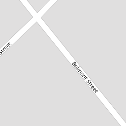
60 Belmont Street
£ 109,000
Description
We don't have a Description for this property.
- Bedrooms
- 4
- Bathrooms
- 0


Leaflet © OpenStreetMap contributors
The heatmap indicates the level of crime in the area. The color of the heatmap indicates the crime severity and recency.
Metrics Year-on-Year
- Average area value
- 337,276.00 £Decreased by 6.99 %
- Average area rental value
- 7,147.00 £/moIncreased by 653.90 %
- Est rental Yield
- 25.43 %Increased by 709.87 %
- Crime Rate
- 4.00 %Unchanged by 0.00 %
from 362,631.00 £
from 948.00 £/mo
from 3.14 %
from 4.00 %
Nearby Schools
| Name | Type | Ofsted | Distance |
|---|---|---|---|
| St Teresa'S Catholic Infant And Nursery School | Voluntary Aided School | Good | 0.62 KM |
| Linaker Primary School | Community School | Requires improvement | 0.74 KM |
| Linaker Children'S Centre | Children's Centre | 0.89 KM | |
| Birkdale Primary School | Community School | Good | 0.91 KM |
| Christ The King Catholic High School And Sixth Form Centre | Voluntary Aided School | Requires improvement | 1.58 KM |
Images
Nearby Streets
| Name | Average Price | Average Sqft | Distance |
|---|---|---|---|
| The Walk | £ 0 | 0 | 0.00 KM |
| The Mews | £ 0 | 0 | 0.00 KM |
| Talbot Drive | £ 0 | 0 | 0.00 KM |
| St. Pauls Street | £ 0 | 0 | 0.00 KM |
| The Walk | £ 195,000 | 0 | 0.00 KM |
Nearby Transport
| Name | NLC | TLC | Distance |
|---|---|---|---|
| Birkdale | 2352 | BDL | 0.77 KM |
| Southport | 2262 | SOP | 1.15 KM |
| Hillside | 2231 | HIL | 2.51 KM |
| Meols Cop | 2357 | MEC | 3.81 KM |
| Ainsdale | 2350 | ANS | 5.50 KM |
Nearby Listings
| Address | Price | Type | Score | Distance |
|---|---|---|---|---|
| Aughton Mews, Birkdale, Southport, Merseyside, PR8 2JX | £ 179,999 | BUY | 5 / 10 | 0.07 KM |
| Lyons Road, Southport, Merseyside, PR8 1JJ | £ 280,000 | BUY | Unknown | 0.09 KM |
| Lyons Road, Birkdale, Southport, Merseyside, PR8 1JJ | £ 279,950 | BUY | 8 / 10 | 0.09 KM |
| Part Street, Southport, PR8 | £ 300,000 | BUY | Unknown | 0.14 KM |
| Part Street, Southport | £ 240,000 | BUY | Unknown | 0.15 KM |
Nearby Properties
| Address | Price | Distance |
|---|---|---|
| 70 Belmont Street | £ 360,000 | 0.00 KM |
| 60 Belmont Street | £ 109,000 | 0.00 KM |
| 78 Belmont Street | £ 132,000 | 0.00 KM |
| 82 Belmont Street | £ 155,000 | 0.06 KM |
| 80 Belmont Street | £ 183,000 | 0.06 KM |