UN
6 Lancaster Road
£ 38,000
Description
We don't have a Description for this property.
- Bedrooms
- 2
- Bathrooms
- 0


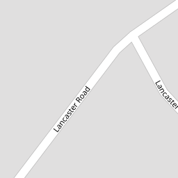


Leaflet © OpenStreetMap contributors
The heatmap indicates the level of crime in the area. The color of the heatmap indicates the crime severity and recency.
Metrics Year-on-Year
- Average area value
- 332,920.00 £Increased by 12.56 %
- Average area rental value
- 875.00 £/moDecreased by 0.91 %
- Est rental Yield
- 3.15 %Decreased by 12.01 %
- Crime Rate
- 4.00 %Unchanged by 0.00 %
from 295,770.00 £
from 883.00 £/mo
from 3.58 %
from 4.00 %
Nearby Schools
| Name | Type | Ofsted | Distance |
|---|---|---|---|
| Greenbank High School | Academy Converter | 1.32 KM | |
| St Teresa'S Catholic Infant And Nursery School | Voluntary Aided School | Good | 2.07 KM |
| Our Lady Of Lourdes Catholic Primary School | Voluntary Aided School | Good | 2.34 KM |
| Farnborough Road First Steps Children'S Centre | Children's Centre | 2.38 KM | |
| Birkdale Primary School | Community School | Good | 2.39 KM |
Images
Nearby Streets
| Name | Average Price | Average Sqft | Distance |
|---|---|---|---|
| Ascot Close | £ 0 | 0 | 0.00 KM |
| Blandford Close | £ 550,000 | 0 | 0.00 KM |
| Grosvenor Gardens | £ 625,000 | 0 | 0.00 KM |
| Greenbank Drive | £ 0 | 0 | 0.00 KM |
| Harrod Drive | £ 650,000 | 0 | 0.00 KM |
Nearby Transport
| Name | NLC | TLC | Distance |
|---|---|---|---|
| Hillside | 2231 | HIL | 1.38 KM |
| Birkdale | 2352 | BDL | 1.39 KM |
| Southport | 2262 | SOP | 3.03 KM |
| Ainsdale | 2350 | ANS | 3.98 KM |
| Meols Cop | 2357 | MEC | 5.81 KM |
Nearby Listings
| Address | Price | Type | Score | Distance |
|---|---|---|---|---|
| Birkdale School for the Hearing Impaired, 40 Lancaster Road | £ 1 | BUY | 7 / 10 | 0.01 KM |
| 5 Lancaster Road, Southport, Merseyside. PR8 | £ 180,000 | BUY | 5 / 10 | 0.01 KM |
| Lancaster Lodge, Lancaster Road, Birkdale, PR8 | £ 170,000 | BUY | 5 / 10 | 0.01 KM |
| Lancaster Road, Southport, Merseyside. PR8 | £ 999,950 | BUY | Unknown | 0.01 KM |
| Lancaster Road, Birkdale, Southport, Merseyside, PR8 2LF | £ 275,000 | BUY | 8 / 10 | 0.06 KM |
Nearby Properties
| Address | Price | Distance |
|---|---|---|
| 6a Lancaster Road | £ 360,000 | 0.00 KM |
| 26 Lancaster Road | £ 650,000 | 0.00 KM |
| 6 Lancaster Road | £ 38,000 | 0.00 KM |
| 20 Lancaster Road | £ 685,000 | 0.00 KM |
| 18 Lancaster Road | £ 655,000 | 0.00 KM |