UN
28 Warren Road
£ 135,000
Description
We don't have a Description for this property.
- Bedrooms
- 2
- Bathrooms
- 0

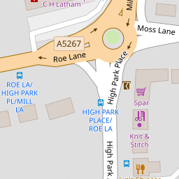

Leaflet © OpenStreetMap contributors
The heatmap indicates the level of crime in the area. The color of the heatmap indicates the crime severity and recency.
Metrics Year-on-Year
- Average area value
- 225,506.00 £Increased by 2.20 %
- Average area rental value
- 1,058.00 £/moIncreased by 5.06 %
- Est rental Yield
- 5.63 %Increased by 2.74 %
- Crime Rate
- 12.00 %Unchanged by 0.00 %
from 220,643.00 £
from 1,007.00 £/mo
from 5.48 %
from 12.00 %
Nearby Schools
| Name | Type | Ofsted | Distance |
|---|---|---|---|
| Bishop David Sheppard Children'S Centre | Children's Centre Linked Site | 0.31 KM | |
| Bishop David Sheppard Church Of England Primary School | Voluntary Aided School | Good | 0.44 KM |
| Churchtown Primary School | Academy Converter | 1.02 KM | |
| St Patrick'S Catholic Primary School | Voluntary Aided School | Outstanding | 1.23 KM |
| Crossens Nursery School | Local Authority Nursery School | Outstanding | 1.45 KM |
Images
Nearby Streets
| Name | Average Price | Average Sqft | Distance |
|---|---|---|---|
| Moss Lane | £ 409,000 | 0 | 0.00 KM |
| Fine Jane's Way | £ 0 | 0 | 0.00 KM |
| Churchgate Mews | £ 0 | 0 | 0.00 KM |
| Carisbrooke Drive | £ 0 | 0 | 0.00 KM |
| Montrose Drive | £ 276,590 | 0 | 0.00 KM |
Nearby Transport
| Name | NLC | TLC | Distance |
|---|---|---|---|
| Meols Cop | 2357 | MEC | 1.48 KM |
| Southport | 2262 | SOP | 4.29 KM |
| Birkdale | 2352 | BDL | 5.94 KM |
| Bescar Lane | 2351 | BES | 6.36 KM |
| Hillside | 2231 | HIL | 7.52 KM |
Nearby Listings
| Address | Price | Type | Score | Distance |
|---|---|---|---|---|
| High Park Road, Southport, Merseyside, PR9 | £ 210,000 | BUY | 7 / 10 | 0.11 KM |
| Church Close, Southport, Merseyside, PR9 | £ 120,000 | BUY | 5 / 10 | 0.11 KM |
| Church Close, Southport, PR9 7QE | £ 180,000 | BUY | 6 / 10 | 0.12 KM |
| Church Close, Southport, PR9 7QE | £ 190,000 | BUY | Unknown | 0.12 KM |
| Warren Road, Southport, PR9 | £ 195,000 | BUY | 6 / 10 | 0.13 KM |
Nearby Properties
| Address | Price | Distance |
|---|---|---|
| 48 Warren Road | £ 163,000 | 0.00 KM |
| 42 Warren Road | £ 122,500 | 0.00 KM |
| 59 Warren Road | £ 204,000 | 0.00 KM |
| 51 Warren Road | £ 147,000 | 0.00 KM |
| 25 Warren Road | £ 124,500 | 0.00 KM |