UN
20 Tape Lane
£ 510,000
Description
We don't have a Description for this property.
- Bedrooms
- 3
- Bathrooms
- 0

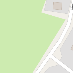
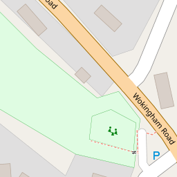

Leaflet © OpenStreetMap contributors
The heatmap indicates the level of crime in the area. The color of the heatmap indicates the crime severity and recency.
Metrics Year-on-Year
- Average area value
- 1,167,115.00 £Decreased by 13.16 %
- Average area rental value
- 2,766.00 £/moIncreased by 74.73 %
- Est rental Yield
- 2.84 %Increased by 101.42 %
- Crime Rate
- 47.00 %Unchanged by 0.00 %
from 1,343,971.00 £
from 1,583.00 £/mo
from 1.41 %
from 47.00 %
Nearby Schools
| Name | Type | Ofsted | Distance |
|---|---|---|---|
| St Nicholas Church Of England Primary, Hurst | Academy Converter | 0.48 KM | |
| Dolphin School | Other Independent School | 1.40 KM | |
| The Colleton Primary School | Community School | Good | 1.65 KM |
| The Starlings Children'S Centre | Children's Centre | 1.71 KM | |
| Polehampton Church Of England Infant School | Academy Converter | 2.72 KM |
Images
Nearby Streets
| Name | Average Price | Average Sqft | Distance |
|---|---|---|---|
| Church Hill | £ 1,325,000 | 0 | 0.00 KM |
| Gooch Close | £ 0 | 0 | 0.00 KM |
| Mallard Close | £ 0 | 0 | 0.00 KM |
| FP Twyford No.3 | £ 0 | 0 | 0.00 KM |
Nearby Transport
| Name | NLC | TLC | Distance |
|---|---|---|---|
| Twyford | 3155 | TWY | 2.29 KM |
| Winnersh | 5697 | WNS | 3.91 KM |
| Winnersh Triangle | 5698 | WTI | 4.71 KM |
| Wargrave | 3158 | WGV | 5.20 KM |
| Wokingham | 5696 | WKM | 5.26 KM |
Nearby Listings
| Address | Price | Type | Score | Distance |
|---|---|---|---|---|
| Tape Lane, Hurst, Reading, Berkshire, RG10 | £ 750,000 | BUY | 7 / 10 | 0.15 KM |
| The Street, Hurst, Berkshire | £ 500,000 | BUY | 4 / 10 | 0.20 KM |
| The Street, Hurst, Reading, Berkshire, RG10 | £ 425,000 | BUY | Unknown | 0.21 KM |
| The Street, Hurst, Reading, Berkshire, RG10 | £ 485,000 | BUY | 7 / 10 | 0.21 KM |
| School Road, Hurst, RG10 | £ 475,000 | BUY | 8 / 10 | 0.29 KM |
Nearby Properties
| Address | Price | Distance |
|---|---|---|
| 20 Tape Lane | £ 510,000 | 0.00 KM |
| Bethany Cottage | £ 550,000 | 0.01 KM |
| Coach House | £ 167,000 | 0.03 KM |
| Rosebank | £ 595,000 | 0.03 KM |
| 13 Tape Lane | £ 274,000 | 0.03 KM |