UN
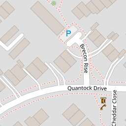
143 Quantock Drive
£ 235,000
Description
We don't have a Description for this property.
- Bedrooms
- 2
- Bathrooms
- 0


Leaflet © OpenStreetMap contributors
The heatmap indicates the level of crime in the area. The color of the heatmap indicates the crime severity and recency.
Metrics Year-on-Year
- Average area value
- 257,097.00 £Decreased by 8.25 %
- Average area rental value
- 956.00 £/moIncreased by 1.92 %
- Est rental Yield
- 4.46 %Increased by 10.95 %
- Crime Rate
- 3.00 %Unchanged by 0.00 %
from 280,201.00 £
from 938.00 £/mo
from 4.02 %
from 3.00 %
Nearby Schools
| Name | Type | Ofsted | Distance |
|---|---|---|---|
| St Teresa'S Catholic Primary School | Academy Converter | Good | 0.48 KM |
| Highworth Grammar School | Academy Converter | Outstanding | 0.75 KM |
| Ashford, St Mary'S Church Of England Primary School | Voluntary Aided School | Good | 0.82 KM |
| Ashford School | Other Independent School | 1.18 KM | |
| Victoria Road Primary School | Community School | Good | 1.28 KM |
Images
Nearby Streets
| Name | Average Price | Average Sqft | Distance |
|---|---|---|---|
| Cotswold Close | £ 510,000 | 0 | 0.00 KM |
| Edinburgh Road | £ 0 | 0 | 0.00 KM |
| New Street | £ 0 | 0 | 0.00 KM |
| High Street | £ 210,000 | 0 | 0.00 KM |
| Grosvenor Drive | £ 0 | 0 | 0.00 KM |
Nearby Transport
| Name | NLC | TLC | Distance |
|---|---|---|---|
| Ashford International | 5004 | AFK | 1.57 KM |
| Wye | 5031 | WYE | 7.24 KM |
| Ham Street | 5037 | HMT | 9.97 KM |
Nearby Listings
| Address | Price | Type | Score | Distance |
|---|---|---|---|---|
| Quantock Drive, Ashford, TN24 | £ 390,000 | BUY | 7 / 10 | 0.02 KM |
| Land at Quantock Drive, Ashford, Kent, TN24 8QP | £ 10,000 | BUY | 7 / 10 | 0.06 KM |
| Exmoor Rise, Ashford, TN24 | £ 260,000 | BUY | 6 / 10 | 0.09 KM |
| Malvern Road, Ashford, Kent, TN24 | £ 575,000 | BUY | 6 / 10 | 0.15 KM |
| Quantock Drive, Ashford TN24 | £ 337,500 | BUY | 7 / 10 | 0.16 KM |
Nearby Properties
| Address | Price | Distance |
|---|---|---|
| 77 Quantock Drive | £ 159,000 | 0.00 KM |
| 131 Quantock Drive | £ 249,000 | 0.00 KM |
| 79 Quantock Drive | £ 166,250 | 0.00 KM |
| 72 Quantock Drive | £ 224,000 | 0.00 KM |
| 74 Quantock Drive | £ 178,000 | 0.00 KM |