UN
47a High Street
£ 35,000
Description
We don't have a Description for this property.
- Bedrooms
- 1
- Bathrooms
- 0
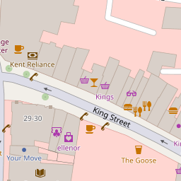

Leaflet © OpenStreetMap contributors
The heatmap indicates the level of crime in the area. The color of the heatmap indicates the crime severity and recency.
Metrics Year-on-Year
- Average area value
- 218,000.00 £Decreased by 24.98 %
- Average area rental value
- 1,250.00 £/moDecreased by 1.73 %
- Est rental Yield
- 6.88 %Increased by 31.05 %
- Crime Rate
- 71.00 %Unchanged by 0.00 %
from 290,603.00 £
from 1,272.00 £/mo
from 5.25 %
from 71.00 %
Nearby Schools
| Name | Type | Ofsted | Distance |
|---|---|---|---|
| Pier View Academy | Other Independent Special School | Requires improvement | 0.50 KM |
| Wrotham Road Primary School | Academy Converter | 0.69 KM | |
| Bronte School | Other Independent School | 0.71 KM | |
| Holy Trinity Church Of England Primary School | Academy Converter | 0.82 KM | |
| Chantry Community Academy | Academy Sponsor Led | Good | 1.04 KM |
Images
Nearby Streets
| Name | Average Price | Average Sqft | Distance |
|---|---|---|---|
| Manor Road | £ 0 | 0 | 0.00 KM |
| Rathmore Road | £ 0 | 0 | 0.00 KM |
| Trinity Point | £ 0 | 0 | 0.00 KM |
| Sheppy Place | £ 0 | 0 | 0.00 KM |
| Bentley Street | £ 500,000 | 0 | 0.00 KM |
Nearby Transport
| Name | NLC | TLC | Distance |
|---|---|---|---|
| Gravesend | 5172 | GRV | 0.33 KM |
| Tilbury Town | 7462 | TIL | 2.72 KM |
| Northfleet | 5120 | NFL | 4.96 KM |
| Ebbsfleet International | 5566 | EBD | 5.33 KM |
| Grays | 7443 | GRY | 6.40 KM |
Nearby Listings
| Address | Price | Type | Score | Distance |
|---|---|---|---|---|
| Princes Street, Gravesend, DA11 | £ 260,000 | BUY | Unknown | 0.13 KM |
| High Street, Gravesend, DA11 | £ 150,000 | BUY | 6 / 10 | 0.16 KM |
| Thames View Court, High Street, Gravesend, DA11 | £ 140,000 | BUY | 6 / 10 | 0.16 KM |
| West Street, Gravesend, Kent, DA11 | £ 220,000 | BUY | 5 / 10 | 0.23 KM |
| Regents Court, Gravesend, DA11 | £ 130,000 | BUY | 6 / 10 | 0.24 KM |
Nearby Properties
| Address | Price | Distance |
|---|---|---|
| 47a High Street | £ 35,000 | 0.00 KM |
| 47b High Street | £ 90,000 | 0.02 KM |
| 37a Princes Street | £ 108,000 | 0.10 KM |
| 22b King Street | £ 470,000 | 0.14 KM |
| 15 Manor Road | £ 105,000 | 0.23 KM |