UN
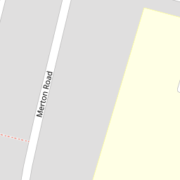
12 Merton Road
£ 250,000
Description
We don't have a Description for this property.
- Bedrooms
- 2
- Bathrooms
- 0

Leaflet © OpenStreetMap contributors
The heatmap indicates the level of crime in the area. The color of the heatmap indicates the crime severity and recency.
Metrics Year-on-Year
- Average area value
- 648,333.00 £Increased by 21.79 %
- Average area rental value
- 1,398.00 £/moDecreased by 2.92 %
- Est rental Yield
- 2.59 %Decreased by 20.31 %
- Crime Rate
- 16.00 %Unchanged by 0.00 %
from 532,315.00 £
from 1,440.00 £/mo
from 3.25 %
from 16.00 %
Nearby Schools
| Name | Type | Ofsted | Distance |
|---|---|---|---|
| Madginford Primary School | Community School | Good | 0.25 KM |
| Roseacre Junior School | Foundation School | Outstanding | 1.20 KM |
| Thurnham Church Of England Infant School | Voluntary Controlled School | Outstanding | 1.23 KM |
| Greenfields Childrens Centre | Children's Centre | 1.58 KM | |
| Greenfields Community Primary School | Community School | Good | 1.62 KM |
Images
Nearby Streets
| Name | Average Price | Average Sqft | Distance |
|---|---|---|---|
| Bradley Court | £ 550,000 | 0 | 0.00 KM |
| Lord Romney's Hill | £ 0 | 0 | 0.00 KM |
| Deringwood Drive | £ 0 | 0 | 0.00 KM |
| Tyler's Croft | £ 0 | 0 | 0.00 KM |
| Garden Walk | £ 587,500 | 0 | 0.00 KM |
Nearby Transport
| Name | NLC | TLC | Distance |
|---|---|---|---|
| Bearsted | 5091 | BSD | 2.08 KM |
| Maidstone East | 5115 | MDE | 4.88 KM |
| Maidstone West | 5222 | MDW | 5.29 KM |
| Maidstone Barracks | 5237 | MDB | 5.63 KM |
| Hollingbourne | 5141 | HBN | 7.16 KM |
Nearby Listings
| Address | Price | Type | Score | Distance |
|---|---|---|---|---|
| Bearsted, ME15 | £ 299,950 | BUY | 7 / 10 | 0.04 KM |
| Merton Road, Bearsted, Maidstone, Kent | £ 310,000 | BUY | 6 / 10 | 0.12 KM |
| Egremont Road, Bearsted, Maidstone | £ 375,000 | BUY | 7 / 10 | 0.18 KM |
| Grenadier Close, Bearsted, Maidstone, Kent, ME15 | £ 565,000 | BUY | 6 / 10 | 0.18 KM |
| Madginford Road, Maidstone | £ 475,000 | BUY | 6 / 10 | 0.24 KM |
Nearby Properties
| Address | Price | Distance |
|---|---|---|
| 14 Merton Road | £ 235,000 | 0.00 KM |
| 4 Merton Road | £ 245,000 | 0.00 KM |
| 12 Merton Road | £ 250,000 | 0.00 KM |
| 50 Merton Road | £ 233,000 | 0.00 KM |
| 30 Merton Road | £ 147,000 | 0.00 KM |