UN
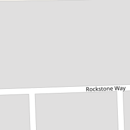
35 Rockstone Way
£ 139,995
Description
We don't have a Description for this property.
- Bedrooms
- 3
- Bathrooms
- 0

Leaflet © OpenStreetMap contributors
The heatmap indicates the level of crime in the area. The color of the heatmap indicates the crime severity and recency.
Metrics Year-on-Year
- Average area value
- 299,571.00 £Decreased by 28.06 %
- Average area rental value
- 2,055.00 £/moIncreased by 21.17 %
- Est rental Yield
- 8.23 %Increased by 68.30 %
- Crime Rate
- 8.00 %Unchanged by 0.00 %
from 416,420.00 £
from 1,696.00 £/mo
from 4.89 %
from 8.00 %
Nearby Schools
| Name | Type | Ofsted | Distance |
|---|---|---|---|
| Laleham Gap School | Foundation Special School | Good | 0.22 KM |
| Newington Community Primary School | Community School | Outstanding | 0.77 KM |
| Newington Children'S Centre | Children's Centre | 0.87 KM | |
| Small Haven School | Other Independent Special School | Good | 1.13 KM |
| Ramsgate Arts Primary School | Free Schools | Good | 1.22 KM |
Images
Nearby Streets
| Name | Average Price | Average Sqft | Distance |
|---|---|---|---|
| Brisbane Drive | £ 0 | 0 | 0.00 KM |
| Hobart Road | £ 222,498 | 0 | 0.00 KM |
| Westland Way | £ 0 | 0 | 0.00 KM |
| St. Johns Crescent | £ 0 | 0 | 0.00 KM |
| St Stevens Park Road | £ 429,225 | 0 | 0.00 KM |
Nearby Transport
| Name | NLC | TLC | Distance |
|---|---|---|---|
| Ramsgate | 5023 | RAM | 2.22 KM |
| Dumpton Park | 5034 | DMP | 4.21 KM |
| Margate | 5018 | MAR | 4.51 KM |
| Broadstairs | 5006 | BSR | 5.25 KM |
| Westgate-On-Sea | 5195 | WGA | 6.61 KM |
Nearby Listings
| Address | Price | Type | Score | Distance |
|---|---|---|---|---|
| Dunedin Road, Ramsgate, CT12 | £ 270,000 | BUY | 7 / 10 | 0.05 KM |
| St Johns Avenue, Ramsgate, Kent, CT12 6JD | £ 300,000 | BUY | 5 / 10 | 0.16 KM |
| Brisbane Drive, Ramsgate, Kent | £ 130,000 | BUY | 4 / 10 | 0.19 KM |
| Rockstone Way, Ramsgate, CT12 | £ 300,000 | BUY | 7 / 10 | 0.24 KM |
| St. Johns Avenue, Ramsgate, CT12 | £ 260,000 | BUY | 6 / 10 | 0.26 KM |
Nearby Properties
| Address | Price | Distance |
|---|---|---|
| 35 Rockstone Way | £ 139,995 | 0.00 KM |
| 30a Rockstone Way | £ 298,000 | 0.00 KM |
| 30 Rockstone Way | £ 140,000 | 0.00 KM |
| 36 Rockstone Way | £ 156,000 | 0.00 KM |
| 22 Rockstone Way | £ 152,000 | 0.00 KM |