UN
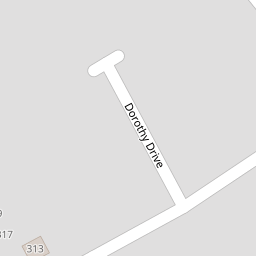
7a Dorothy Drive
£ 240,000
Description
We don't have a Description for this property.
- Bedrooms
- 2
- Bathrooms
- 0


Leaflet © OpenStreetMap contributors
The heatmap indicates the level of crime in the area. The color of the heatmap indicates the crime severity and recency.
Metrics Year-on-Year
- Average area value
- 617,280.00 £Increased by 8.39 %
- Average area rental value
- 2,682.00 £/moIncreased by 50.76 %
- Est rental Yield
- 5.21 %Increased by 38.93 %
- Crime Rate
- 3.00 %Unchanged by 0.00 %
from 569,523.00 £
from 1,779.00 £/mo
from 3.75 %
from 3.00 %
Nearby Schools
| Name | Type | Ofsted | Distance |
|---|---|---|---|
| Dame Janet Primary Academy | Academy Sponsor Led | Good | 0.61 KM |
| Foreland Fields School | Foundation Special School | Good | 0.72 KM |
| The Royal Harbour Academy | Foundation School | Requires improvement | 0.76 KM |
| Small Haven School | Other Independent Special School | Good | 0.98 KM |
| Ramsgate Arts Primary School | Free Schools | Good | 1.00 KM |
Images
Nearby Streets
| Name | Average Price | Average Sqft | Distance |
|---|---|---|---|
| Pysons Road | £ 320,929 | 0 | 0.00 KM |
| Martins Close | £ 274,375 | 0 | 0.00 KM |
| Vincent Close | £ 400,000 | 0 | 0.00 KM |
| Greenfield Road | £ 474,975 | 0 | 0.00 KM |
| St. James Avenue | £ 308,767 | 0 | 0.00 KM |
Nearby Transport
| Name | NLC | TLC | Distance |
|---|---|---|---|
| Ramsgate | 5023 | RAM | 1.22 KM |
| Dumpton Park | 5034 | DMP | 2.45 KM |
| Broadstairs | 5006 | BSR | 3.38 KM |
| Margate | 5018 | MAR | 5.20 KM |
| Westgate-On-Sea | 5195 | WGA | 8.03 KM |
Nearby Listings
| Address | Price | Type | Score | Distance |
|---|---|---|---|---|
| Dorothy Drive, Ramsgate | £ 340,000 | BUY | 7 / 10 | 0.03 KM |
| Dorothy Drive, Ramsgate, Kent, CT12 | £ 375,000 | BUY | 7 / 10 | 0.07 KM |
| Margate Road, Ramsgate, Kent, CT12 | £ 350,000 | BUY | 7 / 10 | 0.14 KM |
| Margate Road,Ramsgate,CT12 6AL | £ 350,000 | BUY | 7 / 10 | 0.15 KM |
| Margate Road, Ramsgate, CT12 6AJ | £ 300,000 | BUY | 7 / 10 | 0.15 KM |
Nearby Properties
| Address | Price | Distance |
|---|---|---|
| 15 Dorothy Drive | £ 265,000 | 0.00 KM |
| 7a Dorothy Drive | £ 240,000 | 0.00 KM |
| 3 Dorothy Drive | £ 285,000 | 0.00 KM |
| 11 Dorothy Drive | £ 145,000 | 0.00 KM |
| 31 Dorothy Drive | £ 150,000 | 0.08 KM |