UN
58 Mill Road
£ 226,000
Description
We don't have a Description for this property.
- Bedrooms
- 4
- Bathrooms
- 0
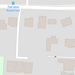

Leaflet © OpenStreetMap contributors
The heatmap indicates the level of crime in the area. The color of the heatmap indicates the crime severity and recency.
Metrics Year-on-Year
- Average area value
- 376,936.00 £Increased by 1.71 %
- Average area rental value
- 1,412.00 £/moIncreased by 13.87 %
- Est rental Yield
- 4.50 %Increased by 11.94 %
- Crime Rate
- 0.00 %
from 370,600.00 £
from 1,240.00 £/mo
from 4.02 %
from 0.00 %
Nearby Schools
| Name | Type | Ofsted | Distance |
|---|---|---|---|
| North Lancing Primary School | Community School | Good | 0.32 KM |
| The Globe Primary Academy | Academy Sponsor Led | Good | 1.22 KM |
| The Sir Robert Woodard Academy | Academy Sponsor Led | Good | 1.33 KM |
| Boundstone Children & Family Centre | Children's Centre | 1.41 KM | |
| Lancing Children & Family Centre | Children's Centre | 1.59 KM |
Images
Nearby Streets
| Name | Average Price | Average Sqft | Distance |
|---|---|---|---|
| The Street | £ 0 | 0 | 0.00 KM |
| Honeysuckle Close | £ 0 | 0 | 0.00 KM |
| Fourth Avenue | £ 462,500 | 0 | 0.00 KM |
| Old Shoreham Road | £ 425,000 | 0 | 0.00 KM |
| West Lane | £ 500,000 | 0 | 0.00 KM |
Nearby Transport
| Name | NLC | TLC | Distance |
|---|---|---|---|
| Lancing | 5275 | LAC | 1.70 KM |
| East Worthing | 5283 | EWR | 4.48 KM |
| Shoreham-By-Sea | 5277 | SSE | 5.41 KM |
| Worthing | 5279 | WRH | 6.74 KM |
| West Worthing | 5278 | WWO | 8.49 KM |
Nearby Listings
| Address | Price | Type | Score | Distance |
|---|---|---|---|---|
| Mill Road, Northing Lancing | £ 700,000 | BUY | Unknown | 0.01 KM |
| Mill Road, North Lancing, West Sussex, BN15 | £ 675,000 | BUY | Unknown | 0.06 KM |
| Mill Road, North Lancing | £ 500,000 | BUY | Unknown | 0.15 KM |
| Browning Road, Lancing, West Sussex, BN15 | £ 750,000 | BUY | Unknown | 0.21 KM |
| Browning Road, North Lancing, West Sussex, BN15 | £ 650,000 | BUY | 6 / 10 | 0.23 KM |
Nearby Properties
| Address | Price | Distance |
|---|---|---|
| 77 Mill Road | £ 340,000 | 0.00 KM |
| 79 Mill Road | £ 522,500 | 0.00 KM |
| 67 Mill Road | £ 370,000 | 0.00 KM |
| 64 Mill Road | £ 480,000 | 0.00 KM |
| 58 Mill Road | £ 226,000 | 0.00 KM |