UN
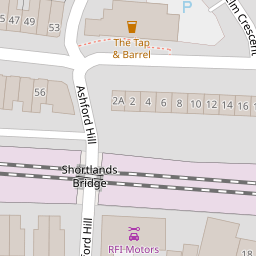
19 Ashford Road
£ 152,000
Description
We don't have a Description for this property.
- Bedrooms
- 3
- Bathrooms
- 0


Leaflet © OpenStreetMap contributors
The heatmap indicates the level of crime in the area. The color of the heatmap indicates the crime severity and recency.
Metrics Year-on-Year
- Average area value
- 332,250.00 £Increased by 4.68 %
- Average area rental value
- 769.00 £/moIncreased by 6.81 %
- Est rental Yield
- 2.78 %Increased by 2.21 %
- Crime Rate
- 4.00 %Unchanged by 0.00 %
from 317,391.00 £
from 720.00 £/mo
from 2.72 %
from 4.00 %
Nearby Schools
| Name | Type | Ofsted | Distance |
|---|---|---|---|
| Lipson Vale Primary School | Community School | Good | 0.83 KM |
| Lipson Co-Operative Academy | Academy Converter | Requires improvement | 0.83 KM |
| Salisbury Road Primary School | Academy Converter | Requires improvement | 0.93 KM |
| Compton Cofe Primary School | Voluntary Controlled School | Good | 1.11 KM |
| Plymouth High School For Girls | Academy Converter | 1.18 KM |
Images
Nearby Streets
| Name | Average Price | Average Sqft | Distance |
|---|---|---|---|
| Ashford Hill | £ 0 | 0 | 0.00 KM |
| Penrose Villas | £ 0 | 0 | 0.00 KM |
| Ivydale Road Lane East | £ 0 | 0 | 0.00 KM |
| Elm Crescent | £ 0 | 0 | 0.00 KM |
| Courtfield Road | £ 0 | 0 | 0.00 KM |
Nearby Transport
| Name | NLC | TLC | Distance |
|---|---|---|---|
| Plymouth | 3580 | PLY | 1.98 KM |
| Devonport | 3579 | DPT | 4.94 KM |
| Dockyard (Devonport) | 3588 | DOC | 5.49 KM |
| Keyham | 3571 | KEY | 5.95 KM |
| St Budeaux Ferry Road | 3590 | SBF | 7.00 KM |
Nearby Listings
| Address | Price | Type | Score | Distance |
|---|---|---|---|---|
| Ashford Road, Plymouth | £ 285,000 | BUY | 5 / 10 | 0.03 KM |
| Ashford Road, Plymouth | £ 275,000 | BUY | 5 / 10 | 0.03 KM |
| Elm Road, Plymouth | £ 125,000 | BUY | 5 / 10 | 0.06 KM |
| Elm Road, Mannamead, Plymouth, PL4 7AY | £ 310,000 | BUY | 6 / 10 | 0.07 KM |
| Ashford Road, Plymouth | £ 300,000 | BUY | Unknown | 0.08 KM |
Nearby Properties
| Address | Price | Distance |
|---|---|---|
| 19 Ashford Road | £ 152,000 | 0.00 KM |
| 13 Ashford Road | £ 137,000 | 0.00 KM |
| 3 Ashford Road | £ 210,000 | 0.00 KM |
| 27 Ashford Road | £ 170,000 | 0.00 KM |
| 45 Ashford Road | £ 158,000 | 0.00 KM |