UN
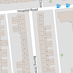
52 Baring Street
£ 35,000
Description
We don't have a Description for this property.
- Bedrooms
- 1
- Bathrooms
- 0


Leaflet © OpenStreetMap contributors
The heatmap indicates the level of crime in the area. The color of the heatmap indicates the crime severity and recency.
Metrics Year-on-Year
- Average area value
- 200,739.00 £Decreased by 34.85 %
- Average area rental value
- 609.00 £/moIncreased by 8.56 %
- Est rental Yield
- 3.64 %Increased by 66.97 %
- Crime Rate
- 11.00 %Unchanged by 0.00 %
from 308,112.00 £
from 561.00 £/mo
from 2.18 %
from 11.00 %
Nearby Schools
| Name | Type | Ofsted | Distance |
|---|---|---|---|
| Mount Street Primary School | Academy Sponsor Led | 0.40 KM | |
| Holy Cross Catholic Primary School | Academy Converter | 0.50 KM | |
| Plymouth High School For Girls | Academy Converter | 0.60 KM | |
| Plymouth College Of Art | Higher Education Institutions | Good | 0.73 KM |
| University Of Plymouth | Higher Education Institutions | 0.78 KM |
Images
Nearby Streets
| Name | Average Price | Average Sqft | Distance |
|---|---|---|---|
| Opie Lane | £ 0 | 0 | 0.00 KM |
| Hill Park Crescent | £ 0 | 0 | 0.00 KM |
| Olivia Court | £ 0 | 0 | 0.00 KM |
| Monica Walk | £ 230,000 | 0 | 0.00 KM |
| Woodside | £ 202,500 | 0 | 0.00 KM |
Nearby Transport
| Name | NLC | TLC | Distance |
|---|---|---|---|
| Plymouth | 3580 | PLY | 1.33 KM |
| Devonport | 3579 | DPT | 4.35 KM |
| Dockyard (Devonport) | 3588 | DOC | 4.96 KM |
| Keyham | 3571 | KEY | 5.54 KM |
| St Budeaux Ferry Road | 3590 | SBF | 6.73 KM |
Nearby Listings
| Address | Price | Type | Score | Distance |
|---|---|---|---|---|
| Baring Street, Greenbank, Plymouth | £ 140,000 | BUY | 5 / 10 | 0.00 KM |
| Baring Street, Greenbank, Plymouth | £ 300,000 | BUY | 5 / 10 | 0.00 KM |
| Baring Street, Plymouth, Devon | £ 210,000 | BUY | Unknown | 0.04 KM |
| Baring Street, Greenbank | £ 115,000 | BUY | Unknown | 0.10 KM |
| Mildmay Street, Plymouth, Devon, PL4 | £ 105,000 | BUY | 5 / 10 | 0.13 KM |
Nearby Properties
| Address | Price | Distance |
|---|---|---|
| 43 Baring Street | £ 208,000 | 0.00 KM |
| 22 Baring Street | £ 65,700 | 0.00 KM |
| 47 Baring Street | £ 175,000 | 0.00 KM |
| 51 Baring Street | £ 143,500 | 0.00 KM |
| 23 Baring Street | £ 170,000 | 0.00 KM |