UN
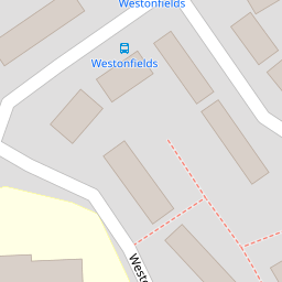
5 Westonfields
£ 285,640
Description
We don't have a Description for this property.
- Bedrooms
- 3
- Bathrooms
- 0


Leaflet © OpenStreetMap contributors
The heatmap indicates the level of crime in the area. The color of the heatmap indicates the crime severity and recency.
Metrics Year-on-Year
- Average area value
- 418,833.00 £Increased by 5.75 %
- Average area rental value
- 1,017.00 £/moDecreased by 11.64 %
- Est rental Yield
- 2.91 %Decreased by 16.62 %
- Crime Rate
- 21.00 %Unchanged by 0.00 %
from 396,049.00 £
from 1,151.00 £/mo
from 3.49 %
from 21.00 %
Nearby Schools
| Name | Type | Ofsted | Distance |
|---|---|---|---|
| Totnes St John'S Church Of England Primary School | Academy Sponsor Led | 0.19 KM | |
| Daisy Play Centre Totnes And District Children'S Centre | Children's Centre | 0.32 KM | |
| Roc College (Part Of United Response) | Special Post 16 Institution | Good | 0.66 KM |
| On Track Education - Totnes | Other Independent Special School | Good | 0.84 KM |
| The Grove School | Community School | Outstanding | 1.46 KM |
Images
Nearby Streets
| Name | Average Price | Average Sqft | Distance |
|---|---|---|---|
| Brooklands | £ 460,000 | 0 | 0.00 KM |
| Pomeroy Villas (private) | £ 0 | 0 | 0.00 KM |
| Bourton Road | £ 0 | 0 | 0.00 KM |
| Elm Walk | £ 265,000 | 0 | 0.00 KM |
| Paradise Walk | £ 0 | 0 | 0.00 KM |
Nearby Transport
| Name | NLC | TLC | Distance |
|---|---|---|---|
| Totnes | 3558 | TOT | 1.69 KM |
Nearby Listings
| Address | Price | Type | Score | Distance |
|---|---|---|---|---|
| Westonfields, Totnes, Devon, TQ9 | £ 325,000 | BUY | 5 / 10 | 0.00 KM |
| Westonfields, Totnes, TQ9 | £ 400,000 | BUY | 6 / 10 | 0.01 KM |
| Westonfields, Totnes, Devon | £ 425,000 | BUY | 6 / 10 | 0.05 KM |
| Higher Westonfields, Totnes | £ 500,000 | BUY | 6 / 10 | 0.15 KM |
| Totnes | £ 425,000 | BUY | 6 / 10 | 0.23 KM |
Nearby Properties
| Address | Price | Distance |
|---|---|---|
| 39 Westonfields | £ 175,000 | 0.00 KM |
| 41 Westonfields | £ 230,000 | 0.00 KM |
| 17 Westonfields | £ 227,500 | 0.00 KM |
| 40 Westonfields | £ 189,950 | 0.00 KM |
| 7 Westonfields | £ 270,000 | 0.00 KM |