UN
9 Chapel Lane
£ 525,000
Description
We don't have a Description for this property.
- Bedrooms
- 4
- Bathrooms
- 0
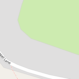


Leaflet © OpenStreetMap contributors
The heatmap indicates the level of crime in the area. The color of the heatmap indicates the crime severity and recency.
Metrics Year-on-Year
- Average area value
- 500,257.00 £Increased by 23.36 %
- Average area rental value
- 1,280.00 £/moIncreased by 46.62 %
- Est rental Yield
- 3.07 %Increased by 18.99 %
- Crime Rate
- 52.00 %Unchanged by 0.00 %
from 405,532.00 £
from 873.00 £/mo
from 2.58 %
from 52.00 %
Nearby Schools
| Name | Type | Ofsted | Distance |
|---|---|---|---|
| East Huntspill Primary Academy | Academy Converter | 0.33 KM | |
| Mark First And Pre-School Ce Academy | Academy Converter | Good | 3.08 KM |
| Woolavington Building | Children's Centre Linked Site | 3.90 KM | |
| Woolavington Village Primary School | Academy Sponsor Led | Requires improvement | 3.96 KM |
| Sedgemoor North | Children's Centre | 4.72 KM |
Images
Nearby Streets
| Name | Average Price | Average Sqft | Distance |
|---|---|---|---|
| Meadow Drive | £ 325,000 | 0 | 0.00 KM |
| Webbers Cottages | £ 985,000 | 0 | 0.00 KM |
| The Stables | £ 0 | 0 | 0.00 KM |
Nearby Transport
| Name | NLC | TLC | Distance |
|---|---|---|---|
| Highbridge And Burnham | 3314 | HIG | 4.15 KM |
Nearby Listings
| Address | Price | Type | Score | Distance |
|---|---|---|---|---|
| Chapel Lane, East Huntspill, Highbridge, Somerset, TA9 | £ 350,000 | BUY | 7 / 10 | 0.01 KM |
| Chapel Lane, East Huntspill, Highbridge, Somerset, TA9 | £ 386,000 | BUY | 7 / 10 | 0.02 KM |
| Mercia Close, Highbridge, TA9 | £ 375,000 | BUY | 7 / 10 | 0.12 KM |
| Hackness Road, East Huntspill, Highbridge, Somerset, TA9 | £ 475,000 | BUY | 7 / 10 | 0.18 KM |
| Mead Close, East Huntspill, Highbridge, Somerset | £ 265,000 | BUY | Unknown | 0.20 KM |
Nearby Properties
| Address | Price | Distance |
|---|---|---|
| 9 Chapel Lane | £ 525,000 | 0.00 KM |
| 2 Chapel Lane | £ 158,000 | 0.00 KM |
| 7 Chapel Lane | £ 128,000 | 0.02 KM |
| Greenway House | £ 270,000 | 0.02 KM |
| 3 Chapel Lane | £ 57,000 | 0.02 KM |