UN
5 Penk Ridge
£ 133,000
Description
We don't have a Description for this property.
- Bedrooms
- 3
- Bathrooms
- 0
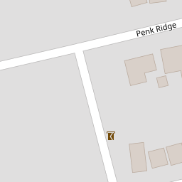


Leaflet © OpenStreetMap contributors
The heatmap indicates the level of crime in the area. The color of the heatmap indicates the crime severity and recency.
Metrics Year-on-Year
- Average area value
- 380,518.00 £Decreased by 11.99 %
- Average area rental value
- 1,244.00 £/moDecreased by 7.16 %
- Est rental Yield
- 3.92 %Increased by 5.38 %
- Crime Rate
- 26.00 %Unchanged by 0.00 %
from 432,358.00 £
from 1,340.00 £/mo
from 3.72 %
from 26.00 %
Nearby Schools
| Name | Type | Ofsted | Distance |
|---|---|---|---|
| Havant And South Downs College | Further Education | Good | 1.38 KM |
| Crookhorn Lane Children'S Centre | Children's Centre Linked Site | 1.40 KM | |
| Morelands Primary School | Community School | Requires improvement | 1.43 KM |
| Riverside Community Special School | Community Special School | Outstanding | 1.57 KM |
| Solent Infant School | Academy Converter | Good | 1.82 KM |
Images
Nearby Streets
| Name | Average Price | Average Sqft | Distance |
|---|---|---|---|
| Brent Lane | £ 495,000 | 0 | 0.00 KM |
| St Thomas Grove | £ 0 | 0 | 0.00 KM |
| A27 | £ 399,043 | 0 | 0.00 KM |
| Anson Close | £ 319,750 | 0 | 0.00 KM |
| Hazelwood Avenue | £ 455,000 | 0 | 0.00 KM |
Nearby Transport
| Name | NLC | TLC | Distance |
|---|---|---|---|
| Bedhampton | 5538 | BDH | 2.96 KM |
| Havant | 5532 | HAV | 4.53 KM |
| Hilsea | 5539 | HLS | 4.67 KM |
| Cosham | 5896 | CSA | 5.05 KM |
| Warblington | 5264 | WBL | 6.11 KM |
Nearby Listings
| Address | Price | Type | Score | Distance |
|---|---|---|---|---|
| Penk Ridge, West Bedhampton | £ 425,000 | BUY | 7 / 10 | 0.00 KM |
| Auriol Drive, Bedhampton | £ 450,000 | BUY | 7 / 10 | 0.08 KM |
| Bedhampton, Hampshire | £ 400,000 | BUY | 6 / 10 | 0.11 KM |
| Fortunes Way, Havant | £ 375,000 | BUY | Unknown | 0.16 KM |
| Havant Road, Bedhampton, PO9 | £ 352,500 | BUY | Unknown | 0.17 KM |
Nearby Properties
| Address | Price | Distance |
|---|---|---|
| 11 Penk Ridge | £ 300,000 | 0.00 KM |
| 7 Penk Ridge | £ 354,000 | 0.00 KM |
| 37 Penk Ridge | £ 203,000 | 0.00 KM |
| 47 Penk Ridge | £ 230,000 | 0.00 KM |
| 13 Penk Ridge | £ 450,000 | 0.00 KM |